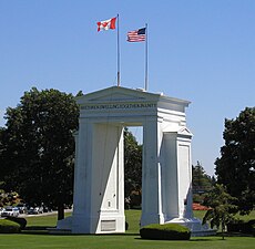
The Canadae–Unitit States border (French: frontière Canada–États-Unis), offeicially kent as the Internaitional Boundary (French: Frontière Internationale), is the langest internaitional border in the warld atween twa kintras. It is shared atween Canadae an the Unitit States, the seicont- an fowerth- lairgest kintras bi aurie, respectively. The terrestrial boondary (includin portions o maritime boondaries in the Great Lochs, an on the Atlantic, Paceefic, an Arctic coasts) is 8,891 kilometre (5,525 mi) lang, o which 2,475 kilometre (1,538 mi) is Canadae's border wi Alaska. Eicht Canadian provinces an territories (Yukon, Breetish Columbie, Alberta, Saskatchewan, Manitoba, Ontario, Quebec, an New Brunswick), an thirteen U.S. states (Alaska, Washington, Idaho, Montana, North Dakota, Minnesota, Michigan, Ohio, Pennsylvania, New York, Vermont, New Hampshire, an Maine) are locatit alang the border.
