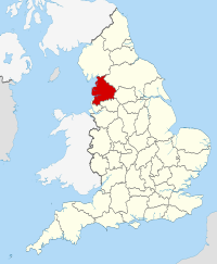
Lancashire
Lancashire (/[unsupported input]ˈlæŋkəʃər/ or, less commonly, /ˈlæŋkəʃɪər/) is a non-metropolitan coonty o historic oreegin in the North Wast o Ingland. It takes its name frae the ceety o Lancaster, an is whiles kent as the Coonty o Lancaster.[2] Awtho Lancaster is still considered tae be the coonty toun, Lancashire Coonty Cooncil is based in Preston. Lancashire is whiles referred tae bi the abbreviation Lancs, as oreeginally uised bi the Royal Mail. The population o the coonty is 1,449,700. Fowk frae the coonty are kent as Lancastrians.
| Lancashire | |
|---|---|
| Coonty | |
 The Red Rose o Lancaster is the coonty flouer o Lancashire, an a common seembol for the coonty. | |
 | |
| Sovereign state | Unitit Kinrick |
| Constituent kintra | Ingland |
| Region | North Wast Ingland |
| Established | c. 1182[1] |
| Ceremonial coonty | |
| Area | 3,079 km2 (1,189 sq mi) |
| • Rankit | 17t o 48 |
| Population (2011 est.) | 1,449,300 |
| • Rankit | 8t o 48 |
| Density | 471/km2 (1,220/sq mi) |
| Ethnicity | 89.7% White Breetish 6.0% S. Asie 2.1% Ither White 0.9% Mixed 0.7% E. Asie an Ither 0.5% Black 2005 Estimates |
| Non-metropolitan coonty | |
| Coonty cooncil |  Lancashire County Council http://www.lancashire.gov.uk |
| Executive | Conservative |
| Admin HQ | Preston |
| Aurie | 2,903 km2 (1,121 sq mi) |
| • Rankit | 16t o 27 |
| Population | 1,169,300 |
| • Rankit | 4t o 27 |
| Density | 403/km2 (1,040/sq mi) |
| ISO 3166-2 | GB-LAN |
| ONS code | 30 |
| NUTS | UKD43 |
 Destricts o Lancashire | |
| Destricts | |
| Members o Pairlament | |
| Time zone | Greenwich Mean Time (UTC) |
| • Simmer (DST) | Breetish Simmer Time (UTC+1) |
Notes an references
eedit- ↑ "Lancashire: county history". The High Sheriff's Association of England and Wales. 2010. Archived frae the original on 4 Mairch 2016. Retrieved 30 December 2015.
- ↑ Vision of Britain – Lancashire
Freemit airtins
eedit| Wikimedia Commons haes media relatit tae Lancashire. |