Californie
Californie is a state in the Unitit States o Americae, on the wast coast. Californie haes the maist indwallers o aa the States o the U.S., an is the third lairgest state bi aurie. The state is the maist physically, and ane of the maist demographically diverse forbye. If Californie wis an unthirlt kintra, it woud hae the 6t lairgest economy in the warld (efter the rest o the U.S., Japan, Germany, the Unitit Kinrick, an the Fowkrepublic o Cheenae). The state's offeecial byname is "The Gowden State," hairkin back tae California's 1849 Gowd Rush.
Californie | |
|---|---|
| State of California | |
| Eik-name(s): The Golden State | |
| Motto(s): | |
| Anthem: "I Love You, California" | |
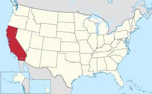
 Map o the Unitit States wi Californie hielichted | |
| Kintra | Unitit States |
| Afore stateheid | Californie Republic |
| Admittit tae the Union | 9 September 1850 (31st) |
| Caipital | Sacramento |
| Lairgest ceety | Los Angeles |
| Lairgest metro | Greater Los Angeles |
| Govrenment | |
| • Govrenor | Gavin Newsom (D) |
| • Lieutenant Governor | Eleni Kounalakis (D) |
| Legislatur | State Legislatur |
| • Upper hoose | State Senate |
| • Lawer hoose | State Assemmly |
| Judiciar | Supreme Coort o Californie |
| U.S. senators | Dianne Feinstein (D) Alex Padilla (D) |
| U.S. Hoose delegation |
|
| Area | |
| • Total | 423,970 km2 (163,696 sq mi) |
| • Laund | 403,932 km2 (155,959 sq mi) |
| • Water | 20,047 km2 (7,737 sq mi) 4.7% |
| Area rank | 3rd |
| Dimensions | |
| • Length | 1,240 km (770 mi) |
| • Width | 400 km (250 mi) |
| Elevation | 880 m (2,900 ft) |
| Highest elevation | 4,421.0 m (14,505 ft) |
| Lowest elevation | −85.0 m (−279 ft) |
| Population (2019) | |
| • Total | 39,512,223[7][8] |
| • Rank | 1st |
| • Density | 97.9/km2 (253.6/sq mi) |
| • Density rank | 11t |
| • Median hooseaud income | $71228 (2018)[9] |
| • Income rank | 9t |
| Demonym(s) | Californian |
| Leid | |
| • Offeecial leid | Inglis |
| • Spoken leid | Leid spoken at hame[10] |
| Time zone | UTC-08:00 (PST) |
| • Summer (DST) | UTC-07:00 (PDT) |
| USPS abbreviation | CA |
| ISO 3166 code | US-CA |
| Trad. abbreviation | Calif., Cal. |
| Latitude | 32°32′ N tae 42° N |
| Longitude | 114°8′ W tae 124°26′ W |
| Website | www |
References
eedit- ↑ "Chapter 2 of Division 2 of Title 1 of the California Government Code". California Office of Legislative Counsel. Retrieved 23 Februar 2019.
- ↑ "Whitney". NGS data sheet. U.S. National Geodetic Survey.
- ↑ "Elevations and Distances in the United States". United States Geological Survey. 2001. Archived frae the original on 15 October 2011. Retrieved 21 October 2011.
- ↑ Elevation adjuistit tae North American Vertical Datum of 1988.
- ↑ The summit o Munt Whitney is the heichest pynt in the Contiguous Unitit States.
- ↑ "USGS National Elevation Dataset (NED) 1 meter Downloadable Data Collection from The National Map 3D Elevation Program (3DEP)—National Geospatial Data Asset (NGDA) National Elevation Data Set (NED)". United States Geological Survey. 21 September 2015. Archived frae the original on 25 Mairch 2019. Retrieved 22 September 2015.
- ↑ "USA: States". citypopulation.de. Retrieved 22 Januar 2020.
- ↑ "Table 1. Annual Estimates of the Resident Population for the United States, Regions, States, and Puerto Rico: April 1, 2010 to July 1, 2019". U.S. Census Bureau. 9 Januar 2020. Retrieved 9 Januar 2020.
- ↑ "Median Annual Household Income". The US Census Bureau. Retrieved 29 Januar 2020.
- ↑ "Languages in California (State)". Statistical Atlas. Archived frae the original on 15 August 2018. Retrieved 15 August 2018.
| Wikimedia Commons haes media relatit tae California. |
| This Unitit States-relatit airticle is a stub. Ye can help Wikipaedia bi expandin it. |

