Tulancingo
Tulancingo (offeecially Tulancingo de Bravo) is the seicont-lairgest ceety in the Mexican state o Hidalgo. It is locatit in the sootheastren pairt o the state an forms ane o the 84 municipalities o Hidalgo an aw, as weel as the Airchdiocese o Tulancingo. Locatit 93 km frae Mexico Ceety, this aurie is the maist important oo textile producer in the kintra an wis hame tae El Santo, Mexico’s maist famous lucha libre warstler. It is hame tae the Huapalcalco aircheological steid an aw, whilk wis the forerunner tae the Teotihuacan ceevilization. The name derives frae the Nahuatl wirds “tule” an “tzintle” whilk mean “in or ahint the reeds.” This is confirmit bi its Aztec glyph.[1]
Tulancingo | |
|---|---|
Municipality an ceety | |
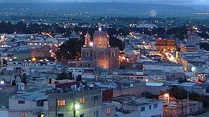
 An fore-nicht view o Tulancingo, frae the Cerro del Tezontle | |
| Coordinates: 20°5′N 98°22′W / 20.083°N 98.367°W | |
| Kintra | |
| State | Hidalgo |
| Municipal seat | Tulancingo |
| Govrenment | |
| • Municipal Preses | Jorge Marquez Alvarado |
| Area | |
| • Total | 290.4 km2 (112.1 sq mi) |
| Elevation | 2181 m (7156 ft) |
| Population (2010) | |
| • Total | 151,582 |
| • Density | 352.64/km2 (913.3/sq mi) |
| Website | http://www.tulancingo.gob.mx |
Sister ceeties
eeditReferences
eedit- ↑ "Estado de Hidalgo Tulancingo de Bravo". Enciclopedia de los Municipios de México (in Spanish). Mexico: Instituto Nacional para el Federalismo y el Desarrollo Municipal. 2005. Archived frae the original on 17 Juin 2011. Retrieved 26 Julie 2010. Unknown parameter
|trans_title=ignored (help)CS1 maint: unrecognised leid (link)
Freemit airtins
eedit- Municipio Tulancingo Archived 2020-03-20 at the Wayback Machine Offeecial wabsteid
- State o Hidalgo Archived 2012-11-07 at the Wayback Machine Offeecial wabsteid

