Eastriggs
Eastriggs is a smaw veelage locatit in the historical coonty o Dumfriesshire in Dumfries an Gallowa, soothwast Scotland. The veelage is locatit aboot 2 mile north o the clartbaunks an the saundbanks o the chainel o the River Eden that stends wast intil the Solway Firth.
| Eastriggs | |
|---|---|
 Eastriggs Location within Dumfries an Gallowa | |
| Population | 1,683 [1] (2001 census) est. 1,790[2] (2006) |
| OS grid reference | NY247662 |
| Cooncil area | |
| Lieutenancy area | |
| Kintra | Scotland |
| Sovereign state | Unitit Kinrick |
| Post toun | ANNAN |
| Postcode destrict | DG12 |
| Diallin code | 01461 |
| Police | Scots |
| Fire | Scots |
| Ambulance | Scots |
| EU Pairlament | Scotland |
| UK Pairlament | |
| Scots Pairlament | |
Traivelin bi road, Eastrigg is 3 mile til the east o Annan, 19 mile til the east o Dumfries, 5 mile til the wast o Gretna about 18 mile wast o Cairl an about 83 mile til the sooth o Edinburgh.
The B71 road rins throu Eastrigg an ither neebourin touns an veelages connectin til the nearby A75 road.
History
eeditSituatit in the pairish o Dornock in the tradeetional coonty o Dumfriesshire, Eastriggs appears tae hae taen its name fae the ferm, or ferm hoose, kent as Eastriggs that wis locatit in mid o whit wis tae become the new sattlement.[3] The anely ither biggins in the aurie afore Warld War I wis a curn o hooses at Lowtherton (noo North Road, Lowtherton); a parpen curn on whit is noo the B721 road; an in an a smiddy whaur the East Road jynes the B721.[3]
The sattlement o Eastriggs wis creatit as an upshot o the Shell Creesis o 1915 that gart the newly foondit Meenistry o Munitions tae creaut a new cordite warks.[4]
Designatit offeecial HM Factory, Gretna, the warks wis spreid ower a 9-mile site streetchin fae Dornock throu Gretna tae Langtoon in Cumbria.[5] This require't a muckle influx o labour, an 30,000 men an weemen cam fae aw ower the Commonweel o Nations tae serve as biggin wirkers an factory wirkers.[6]

(demolisht in Mairch 2010)
Sir Raymond Unwin, the Chief Hoosin Airchitect o the hoosin brainch o the Explosives Depairtment o the Meenistry o Munitions, designt widden hoosin for the wirkers in baith Eastriggs an Gretna.[7] As a merk o respct for the immigrant wirkers, the streets wis name't efter various ceetys in the Commonweel.[6]
Governance
eeditEastriggs is in the UK pairlamentary constituency o Dumfriesshire, Clydesdale and Tweedale. David Mundell is the praisent Scots Conservative Pairty Member o Pairlament.
It is pairt o the Sooth Scotland region in the Scots Pairlament, bein in the constituency o Dumfriesshire. Oliver Mundell o the Scots Conservative Pairty is the MSP.
Afore Brexit, for the European Pairlament its residenters votit tae elect MEPs for the Scotland constituency.
Kirk o St John the Evangelist
eedit
Designt in the Gothic style bi C M Crickmer unner the direction o Sir Raymond Unwin,[8] the Kirk o St John the Evangelist wis dedicatit in 197 an wis propine't wi a signt altar beuk the follaein year bi Keeng George V an Queen Mary that wis veesitin HM Factory, Gretna.
Rail transport
eeditThe Glasgow South Western Line connectin Cairl, Gretna Green, an Annan passes throu the praisently closed Eastriggs railwey station. This station is disuised, bit the're plans tae provide a smawer replacement on the line, that haes been upgradit fae single tae double track, enablin simultaenous passenger an fraucht traffeck.
References
eedit- ↑ "Comparative Population Profile: Eastriggs Locality". Scotland's Census Results Online. 29 Apryle 2001. Archived frae the original on 19 Mey 2011. Retrieved 3 September 2008.
- ↑ Statistics from the gro-scotland.gov.uk site Archived September 16, 2009, at the Wayback Machine Retrieved on 3 September 2008
- ↑ a b Victorian OS Sheet 6
- ↑ Ministry of Munitions of War, Preface
- ↑ Ministry of Munitions of War, Chapter 2: Water Supply
- ↑ a b Longtown Military Railway
- ↑ Stratton & Trinder (2000)
- ↑ Scottish Churches Architectural Heritage Trust[deid airtin] Retrieved on 7 September 2008
Notes
eedit- Reprinted one-inch Victorian Ordnance Survey Maps of Scotland (Sheet 6), Annan & Whithorn. 1st edition revised to 1896. Kyle of Lochalsh: Caledonian Maps. ISBN 1-85349-006-7.
- Ordnance Survey Landranger Map (number 85) - 1:50,000 scale (1.25 inches to 1 mile). ISBN 0-319-22685-9.
- Ordnance Survey Explorer Map (number 323) - 1:25,000 scale (2.5 inches to 1 mile)
- Ministry of Munitions of War, (1918). H.M. Factory, Gretna: Description of Plant and Process. Dumfries: J. Maxwell & Son for His Majesty's Stationery Office.
- Stratton, Michael and Trinder, Barrie (2000). Twentieth Century Industrial Archaeology. London: E & FN Spon. ISBN 0-419-24680-0.
- Video/DVD, (1994). The Longtown Military Railway. Carnfort
Gailerie
eedit-
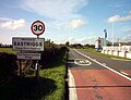 Eastriggs, The Commonweel Veelage, fae the east.
 -
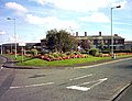 Eastriggs fae the wast
 -
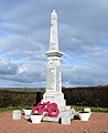 Dornock an Eastriggs war memorial


External links
eedit| Wikimedia Commons haes media relatit tae Eastriggs. |
- Eastriggs Primary Schuil on annan.org.uk
- Eastriggs Primary Schuil on scottishschoolsonline.gov.uk[deid airtin]
| This Places o Scotland airticle is a stub. Ye can help Wikipaedia bi expandin it. |