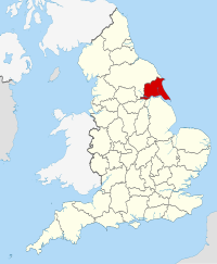
East Riding of Yorkshire

| |
| Geography | |
| Status | Ceremonial county and (smaller) unitary destrict |
|---|---|
| Oreegin | Historic diveesion |
| Region | Yorkshire an the Humber |
| Aurie - Total - Destrict - Destrict aurie |
Rankit 23rd 2,479 km² [[Leet o Inglis destricts bi aurie|Rankit 5t]] 2,409 km² |
| Admin. HQ | Beverley |
| ISO 3166-2 | GB-ERY (excludes Hull) |
| ONS code | 00FB |
| NUTS 3 | UKE11/12 |
| Chapman code | ERY |
| Demographics | |
| Population - Total (mid-2016 est.) - Density - District - District. pop. |
Ranked 37t 602,600 139 / km² [[List of English districts by population|Ranked 18t]] |
| Ethnicity | 98.3% White 1.1% S.Asian[1] |
| Politics | |
East Riding of Yorkshire Council http://www.eastriding.gov.uk/ | |
| Leadership | Leader & Cabinet |
| Executive | Conservative |
| Members o Parliament | |
| Districts | |

| |
The East Riding of Yorkshire, or simply East Yorkshire, is a local govrenment destrict wi unitary authority status, an a ceremonial coonty o Ingland. For ceremonial purposes, the coonty includes the ceety o Kingston upon Hull, which is a separate unitary authority. It is namit efter the historic East Riding o Yorkshire (ane o three ridings alangside the North Riding an Wast Riding), whilk constitute a ceremonial an administrative coonty till 1974 an aw. Frae 1974 tae 1996 the aurie o the modren East Riding o Yorkshire constitutit the northren pairt o the nan-metropolitan coonty o Humberside.
References
eedit- ↑ "Resident Population Estimates by Ethnic Group (Percentages); Mid-2005 Population Estimates". National Statistics Online. Office for National Statistics. Archived frae the original on 12 Juin 2011. Retrieved 28 Mairch 2008.
Freemit airtins
eedit| Wikimedia Commons haes media relatit tae East Riding of Yorkshire. |
- Data Observatory - East Riding of Yorkshire Council Archived 2008-12-20 at the Wayback Machine
Template:East Yorkshire Template:Unitary authorities o Ingland