Tepezalá, Aguascalientes
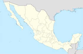
Tepezalá is a toun in the Mexican state o Aguascalientes. It staunds at 22°13′N 102°10′W / 22.217°N 102.167°W. It servs as the municipal seat for the surroondin municipality o Tepezalá.
Tepezalá | |
|---|---|
Toun | |
 Municipality location in Aguascalientes | |
| Coordinates: 22°13′N 102°10′W / 22.217°N 102.167°W | |
| Kintra | |
| State | Aguascalientes |
| Municipality | Tepezalá Municipality |
Tepezala is locatit on the fuithills o the eastren muntains o the state, a laund rich in minerals an arid in vegetation that wis on the auld Siller Route durin the 16t century, which brocht sae hintle walth tae the region an help conquer the inhospitable north o Mexico. The toun's mines made it famous an brocht walth tae the state.
Climate
eedit| Climate data for Tepezala | |||||||||||||
|---|---|---|---|---|---|---|---|---|---|---|---|---|---|
| Month | Jan | Feb | Mar | Apr | May | Jun | Jul | Aug | Sep | Oct | Nov | Dec | Year |
| Average heich °C (°F) | 21.9 (71.4) |
23.7 (74.7) |
26.4 (79.5) |
29.3 (84.7) |
30.7 (87.3) |
29.8 (85.6) |
27.3 (81.1) |
27.0 (80.6) |
26.0 (78.8) |
25.7 (78.3) |
24.2 (75.6) |
22 (72) |
26.2 (79.1) |
| Average law °C (°F) | 3.8 (38.8) |
5 (41) |
7 (45) |
9.9 (49.8) |
11.8 (53.2) |
12.9 (55.2) |
12 (54) |
11.6 (52.9) |
11.4 (52.5) |
9.5 (49.1) |
6.0 (42.8) |
4.4 (39.9) |
8.8 (47.8) |
| Average precipitation mm (inches) | 15 (0.6) |
10 (0.4) |
5.1 (0.2) |
7.6 (0.3) |
20 (0.8) |
58 (2.3) |
110 (4.5) |
94 (3.7) |
74 (2.9) |
28 (1.1) |
7.6 (0.3) |
13 (0.5) |
442.3 (17.6) |
| Source: Weatherbase [1] | |||||||||||||
References
eedit- ↑ "Weatherbase: Historical Weather for Tepezala, Aguascalientes". Weatherbase. 2011.[deid airtin] Retrieved on November 24, 2011.
Freemit airtins
eedit- http://www.aguascalientes.gob.mx/estado/m_tep.html Archived 2004-10-30 at the Wayback Machine
