Obolon Raion
Obolon Raion (Ukrainian: Оболонський район, Obolons’kyi raion), is a municipal raion (admeenistrative destrict) o the Ukrainian caipital Kiev. Obolon Raion encompasses territories far ayont o its historical neebourheid sharin the same name. It wis formit on 3 Mairch 1975 an initially cried as Minsk Raion. In 2001 it wis renamit tae its historical name. Its current population is 290,000 inhabitants.
Obolon Raion Оболонський район | |
|---|---|
 | |
| Kintra | |
| Ceety Municipality | |
| Main neebourheids | Leet
|
| Govrenment | |
| • Council Heid | Vadym Yahodka |
| Area | |
| • Total | 110.2 km2 (42.5 sq mi) |
| Population | |
| • Total | 306,000 |
| • Density | 2776/km2 (7,190/sq mi) |
| Time zone | UTC+2 (EET) |
| • Summer (DST) | UTC+3 (EEST) |
| Landmarks | Obolon CJSC |
| Metro stations | Petrivka, Obolon, Minska, Heroiv Dnipra |
| Website | http://obolonrda.gov.ua/ |
Overview
eeditDurin Soviet rule o Ukraine, Kiev haed 14 admeenistrative destricts. In early 21st century, a new law wis passed an the raions wur reorganisit intae 10 raions wi different borders an new names.
The Obolon destrict encompasses the territories o the umwhile Minskiy district and is still sometimes referred tae bi that name. It includes the umwhile toun o Pushcha-Vodytsia that uised tae be pairt o the Podil Raion an aw. The name Obolon comes frae the Auld-Ukrainian wird оболонь → болонь → болоньє (obolon' → bolon' → bolon'ye), which roughly translates as "flood plain" or a aurie that is bein engulfit bi watter. The destrict wis built up in the 1970s as a microdestrict in Kiev on the Obolon sands tae satisfee the growthe o the ceety. Due tae the composition o the soil at the time, the majority o the biggins wur at maist nine-stories taw, an few trees wur plantit when compared tae ither pairts o the ceety. That an few ither raosons oreeginally made the destrict no vera prestigious.
Wi the seicont construction period (2000–2005), the destrict haes seen new, comfortable apairtment biggins constructit closer tae the Dnieper river an haes become a attractive residential aurie. The new apairtments are hintle mair expensive an aw, awtho still cheaper than in the central pairts o Kiev. The destrict wis connectit bi metro in the 1980s, wi a station Obolon opened on 5 November 1980.
A yachtin club for baith kids an adults wis opened in aroond 1990, an recently mony o the Obolon lochs wur cleaned up in order tae mak the aurie mair attractive. The aurie closer tae the Dnieper river is a popular relaxation place for Kiev residents. The aurie is weel kent for the beer factory Obolon CJSC an aw.
Major neebourheids
eedit- Obolon, a residential massif an a industrial zone o the Kiev ceety. It is locatit atween Dnieper river, Moscow Parkway, Verbova Street, an Dehtiarenko Street.
- Kurenivka, an aurie towards the dountoun o Kiev. In 17t century it uised tae be a suburb o the Kiev ceety whaur the Kiev Cossack Kosh wis garrisoned. Its name is derivit frae ane o the cossack's militar formations, kurin (company). In 18th century thare wis built the Petropavlivska Kirk that in the Soviet times wis destroyed an rebuilt unner ane o the industrial biggins. Kurenivka is became famous for a massive tragedy o the Kurenivka mudslide in 1961 an aw.
- Priorka, it is believit tae be settled bi monks o the Dominican Order on the road tae Vyshhorod. Syne 1834 the dounset wis incorporatit intae the Kiev-ceety.
- Minsk massif, a residential aurie o Kiev. It is locatit atween Shevchenko Square, Minsk Parkway, Konradyuk Street, Maiorov Street, Panch Street, Polyarna Street. The aurie conteens "sub-neebourheid" Kyn-Grust an aw which carries a urban legend tee'd tae Yekaterina II an Prince Potemkin who supposedly gave names tae aw the touns in Ukraine.
Gallery
eedit-
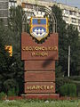 The sign when enterin the raion
 -
 Obolon embankment
 -
 Obolon bay


See an aw
eeditFreemit airtins
eedit| Wikimedia Commons haes media relatit tae Obolon. |
- Brief history o the Obolon an Minskyi destricts Archived 2005-03-05 at the Wayback Machine
- (in Ukrainian) obolonrda.gov.ua Archived 2008-02-06 at the Wayback Machine – Obolon Raion admeenistration wabsteid
- (in Roushie) Unoffeecial Kiev Metro steid Archived 2015-08-16 at the Wayback Machine – Information aboot the Obolon metro station
- (in Ukrainian) Оболонь in Web Encyclopedia Kiev
Coordinates: 50°31′1.2″N 30°30′8.3″E / 50.517000°N 30.502306°E