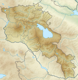
Moont Aragats
The "Scots" that wis uised in this airticle wis written bi a body that haesna a guid grip on the leid. Please mak this airticle mair better gin ye can. (September 2020) |
Mount Aragats ((Armenie: Արագած լեռ[5]), pronounced [aɾaˈgats]) is an isolatit fower-peaked volcano massif in Armenie. Its northren summit, at 4,090 m (13,420 ft) abuin sea level, is the heichest pynt o the Lesser Caucasus an Armenie. It is an aa ane o the heichest pynts in the Armenie Hielands.[a]
| Moont Aragats | |
|---|---|
 | |
| Heichest pynt | |
| Elevation | 4,090 m (13,420 ft) [1][2] |
| Prominence | 2,143 m (7,031 ft) [3] |
| Isolation | 88.62 kilometre (55.07 mi) |
| Leetin | Kintra heich pynt Ultra |
| Coordinates | 40°32′00″N 44°12′00″E / 40.53333°N 44.20000°ECoordinates: 40°32′00″N 44°12′00″E / 40.53333°N 44.20000°E |
| Geografie | |
| Location | Aragatsotn Province an Shirak Province, Armenie |
| Parent range | Lesser Caucasus |
| Geology | |
| Age o rock | Holocene[1] |
| Muntain teep | Stratovolcano |
| Last eruption | Unkent[1] |
| Climbing | |
| First ascent | Julie 1843 Khachatur Abovian an Moritz Wagner[4] |
Notes
eedit- ↑ Acause the Armenie Hielands isna a well-defined aurie, soorces vary greatly on whaur Aragats ranks. Some soorces cry it the seicont heichest (efter Moont Ararat in Turkey),[6][7] ithers the third heichest (efter Ararat an Süphan, an aa in Turkey)[8][9] an some the fowert heichest (efter Ararat, Sabalan in Iran, an Süphan).[10]
References
eedit- ↑ a b c "Aragats". Global Volcanism Program. Smithsonian Institution.
- ↑ Հայաստանի Հանրապետության Ֆիզիկաաշխարհագրական օբյեկտների համառոտ տեղեկատու-բառարան (PDF) (in Armenian). State Committee of the Real Estate Cadastre. 2007. p. 15. Archived frae the original (PDF) on 17 Mey 2018. Retrieved 19 Mairch 2017. Unknown parameter
|trans_title=ignored (help) - ↑ "High prominence mountains in Caucasus and Russia outside of Europe". ii.uib.no. Institutt for informatikk University of Bergen.
- ↑ Ketchian, Philip K. (24 December 2005). "Climbing Ararat: Then and Now". The Armenian Weekly. 71 (52). Archived frae the original on 8 September 2009. Unknown parameter
|deadurl=ignored (help) - ↑ https://www.armgeo.am/aragats/
- ↑ "Արագած". armgeo.am (in Armenian). Armenian Geographic. 27 Mey 2015.
- ↑ Aslani︠a︡n, A. T. (1973). "Yerevan-Southern Summit of Aragats Volcano". Guide-book of Excursions of the All-union Conference for the Study of the Quaternary Period: Armenian SSR. Academy of Sciences of the Armenian SSR Institute of Geological Sciences. p. 72.
By its height among the highest peaks of the Armenian highland Aragats gives way only to Ararat — the famous biblical mountain that rises for more than 1 km.
- ↑ Hewsen, Robert H.; Anania Shirakatsi (1992). The Geography of Ananias of Širak: Ašxarhacʻoycʻ, the Long and the Short Recensions. Reichert. p. 217. ISBN 9783882264852.
The highest peak in the Armenian SSR, Aragac is the third highest mountain on the Armenian plateau after Ararat (16,916 ft. /5172 m), and Sip'an (Subhan, 14,543/4434).
- ↑ Smith, Adam T. (2009). "Regional Investigations in the Tsaghkahovit Plain: Orientation and Methodology". The Foundations of Research and Regional Survey in the Tsaghkahovit Plain, Armenia. Oriental Institute of the University of Chicago. p. 95. ISBN 9781885923622.
Aragats is the third highest peak in the Armenian Highland after Great Ararat (5,165 m a.s.l.) and Süphan Dağı (4,434 m a.s.l.).
- ↑ Nazarian, Kh. (1974). "Արագած (Aragats)". Soviet Armenian Encyclopedia Volume I (in Armenian). p. 677–678.
| This airticle is a stub. Ye can help Wikipaedia bi expandin it. |
