Gornji Milanovac
Gornji Milanovac (Serbie: Горњи Милановац ![]() listen (help·info)) is a toun an municipality locatit in Serbie at 44.012691° North, 20.273572° East. Its name means "Upper Milanovac" (there is a Lower Milanovac, as well) while Milanovac stems from name "Milan" in the Serbian leid. In 2003 the ceety haed a total population o 24,000.
listen (help·info)) is a toun an municipality locatit in Serbie at 44.012691° North, 20.273572° East. Its name means "Upper Milanovac" (there is a Lower Milanovac, as well) while Milanovac stems from name "Milan" in the Serbian leid. In 2003 the ceety haed a total population o 24,000.
Gornji Milanovac Горњи Милановац Despotovac | |||||||
|---|---|---|---|---|---|---|---|
Toun an municipality | |||||||
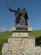
Clockwise, frae tap: Toun centre at nicht, Takovski ustanak gymnasium, Kirk o Haly Trinity, "Takovski grm" Memorial Complex, The Auld Coort biggin | |||||||
| Motto(s): "Време и моје право (Time and my right)" | |||||||
 Location o the municipality o Gornji Milanovac within Serbie | |||||||
| Coordinates: 44°01′27″N 20°27′36″E / 44.02417°N 20.46000°ECoordinates: 44°01′27″N 20°27′36″E / 44.02417°N 20.46000°E | |||||||
| Kintra | |||||||
| Region | Šumadija an Wastren Serbie | ||||||
| Destrict | Moravica | ||||||
| Foondit | 1853 | ||||||
| Settlements | 63 | ||||||
| Govrenment | |||||||
| • Mayor | Dejan Kovačević (SNS) | ||||||
| Area | |||||||
| Area rank | 21st | ||||||
| • Municipality | 836 km2 (323 sq mi) | ||||||
| Elevation | 310 m (1,020 ft) | ||||||
| Population (2011 census)[2] | |||||||
| • Rank | 37t | ||||||
| • Toun | 24216 | ||||||
| • Municipality | 44406 | ||||||
| Time zone | UTC+1 (CET) | ||||||
| • Summer (DST) | UTC+2 (CEST) | ||||||
| Postal code | 32300 32301 | ||||||
| Aurie code | +381(0)32 | ||||||
| Caur plates | GM | ||||||
| Website | www | ||||||
Afore 1859 the oreeginal name o the ceety wis Despotovac, efter the Despotovica river passin bi the ceety. In 1859 the name wis chynged tae Gornji Milanovac at the request o the Prince o Serbie Miloš Obrenović.
Geography
eeditGornji Milanovac lies atween muntains Rudnik tae the north an Vujan tae the sooth.
The ceety is situatit alang wastren side o European route E763, atween the ceeties Ljig tae the north an Čačak tae the sooth an the veelages Majdan tae the north an Preljina tae the sooth.
Main ceety crossroad branches:
- Tae the North, ontae road Gornji Milanovac-Kragujevac (see Kragujevac) that crosses wi E763 an turns East; the nearest veelage on the road is Donja Vrbava.
- Tae the East, turns Sooth then East through the ceety, crosses E763 an then goes Sooth through the veelage o Donja Trepca ontae the route 23.
- Tae the Sooth, towards E763.
- Tae the Wast, quickly turns North an efter five kilometers branches intae road Gornji Milanovac-Cestobrodica (see Cestobrodica) tae the Wast; the nearest veelage on the road is Takovo, whaur Takovo Uprising begun; an intae road Gornji Milanovac-Gornji Banjani (see Gornji Banjani) tae the North; the nearest veelage on the road is Kalimanici.
Sooth o Milanovac, veelages Brdjani tae the Wast an Prislonica tae the East are connectit tae E763 wi local roads.
Twin touns — sister ceeties
eeditGornji Milanovac is twinned wi:
Gallery
eedit-
Kirk o Holy Trinity
-
Auld Court
-
Winter view o the Gornji Milanovac
-
Monument on the hill o peace
-
Hoose o the Serbo-Norse friendship (kol. "Norawa Hoose")
References
eedit- ↑ "Municipalities of Serbia, 2006". Statistical Office of Serbia. Retrieved 28 November 2010.
- ↑ "2011 Census o Population, Hoosehaulds an Dwallins in the Republic o Serbie: Comparative Owerview o the Nummer o Population in 1948, 1953, 1961, 1971, 1981, 1991, 2002 an 2011, Data bi settlements" (PDF). Stateestical Office o Republic O Serbie, Belgrade. 2014. ISBN 978-86-6161-109-4. Retrieved 27 Juin 2014.
Freemit airtinss
eedit| Wikimedia Commons haes media relatit tae Gornji Milanovac. |
- Offeecial site Archived 2020-11-08 at the Wayback Machine
- GM032.net Internet Portal o the Municipality o Gornji Milanovac Archived 2011-01-20 at the Wayback Machine
- Tourist Organisation o the Municipality o Gornji Milanovac Archived 2012-02-22 at the Wayback Machine
- GornjiMilanovac.org internet Portal Archived 2019-01-02 at the Wayback Machine Template:Municipalities o Serbie
- http://plavosrce.com /razvojna inicijativa oblasti/


