Galápagos Province
Galápagos is a province o Ecuador in the kintra's Insular region, locatit approximately 1,000 km (620 mi) aff the wastren coast o the mainland. The caipital is Puerto Baquerizo Moreno.
Galápagos Provincia de Galápagos | |
|---|---|
Province | |
| Province o Galápagos | |
 Banner | |
| Eik-name(s): ARCHIPIELAGO OF GALAPAGOS | |
 Location o Galápagos Province | |
 Cantons o Galápagos Province | |
| Kintra | Ecuador |
| Creatit | 18 Februar 1973 |
| Named for | Galápagos Islands |
| Caipital | Puerto Baquerizo Moreno |
| Cantons | Leet o cantons
|
| Govrenment | |
| • Govrenor | Jorge Torres (2008-) |
| Area | |
| • Province | 45000 km2 (17,000 sq mi) |
| • Laund | 8010 km2 (3,090 sq mi) |
| Highest elevation | 1710 m (5,610 ft) |
| Lowest elevation | 0 m (0 ft) |
| Population (2006) | |
| • Province | 19,184 |
| • Density | 0.43/km2 (1.1/sq mi) |
| • Urban | 16,317 |
| Galápagos wis the anerlie province measured in the 2006 census. | |
| Time zone | UTC-6 (GALT) |
| Area code(s) | (0)5 |

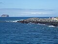
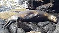
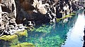
The province admeenisters the Galápagos Islands, a group o tiny volcanic islands that sit on the equator. The Galápagos Islands hae for centuries captured the interest o fowk frae aw ower the globe acause o its unique biodiversity that wis made famous bi Charles Darwin an his theory o evolution.
History
eeditIt is estimatit that the islands wur formit 8 million years ago as a result o tectonic activity on the seabed. The airchipelago wis likely inhabitit lang ago: the splorer Thor Heyerdahl in 1963 reportit that he foond the Inca airchaeological steids an objects. The Galapagos Islands wur discovered bi chance on 10 Mairch 1535, when the Dominican friar Fray Tomas de Berlanga, Bishop o Panama, went tae Peru in pursuance o an order o the Spainyie monarch, Charles V, tae arbitrate in a dispute atween Francisco Pizarro an his subordinates efter the conquest o the Inca Empire. Acause o a calm an strang currents, the ship o Bishop wis draggit tae the Galapagos. In chronicling his adventur, directit frae Portoviejo Emperor Charles V on the discovery o the Galapagos Islands, Berlanga describit the bleak desert conditions in the islands an the giant tortoises that inhabitit them.
Poleetical diveesions
eeditCantons
eeditThe province is dividit in three cantons, each encompassin a nummer o islands. Thay are:
| Canton | Pop. | Aurie (km²) |
Caipital | Principal islands |
|---|---|---|---|---|
| Isabela | 1,780 | 5,367 | Puerto Villamil | Darwin, Fernandina, Isabela, Wolf |
| San Cristóbal | 6,142 | 849 | Puerto Baquerizo Moreno | Española, Floreana, Genovesa, San Cristóbal, Santa Fe |
| Santa Cruz | 11,262 | 1,794 | Puerto Ayora | Baltra, Bartolomé, Marchena, North Seymour, Pinta, Pinzón, Rábida, Santa Cruz, Santiago |
| Galápagos | 19,184 | 8,010 | Puerto Baquerizo Moreno | [1] |
Gallery
eedit-

-
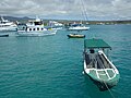
 Boats in Puerto Ayora on the Island o Santa Cruz
 -
 Sailboats in Puerto Ayora
 -
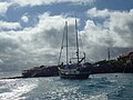 Sailboat in the Puerto Ayora
 -
 Twa Deuks in Puerto Ayora on the Island o Santa Cruz, Galápagos
 -
-
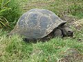
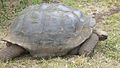 Gigantic galapagos turtle on Santa Cruz
 -
 Gigantic galapagos turtle on the island o santa cruz
 -
 Gigantic galapagos turtle on the island o santa cruz
 -

-

-

-
-
-
-
 Iguana
 -
 Haund carvit turtle
 -
 Galapagos Coffee
 -
 Watter taxi on Puerto Ayora
 -
 Puerto Ayora at nicht
 -
 Santa Cruz
 -
 Tortuga Bay - Santa Cruz
 -
 North Seymour Island
 -
 North Seymour Island


See an aw
eeditReferences
eedit- ↑ (in Spaingie) Censo de Población y Vivienda, Galápagos 2006 Archived 2009-09-19 at the Wayback Machine. Instituto Nacional de Estadistica y Censos (INEC).
Freemit airtins
eedit| Wikimedia Commons haes media relatit tae Province of Galápagos. |
- Galapagos National Park Archived 2002-06-13 at the Wayback Machine
- Galápagos Islands xeric scrub (World Wildlife Fund)
- Galápagos geologie, wi general information on the Galápagos Islands
- INEC map o the cantons Archived 2008-11-19 at the Wayback Machine
- Parishes athin the cantons Archived 2009-06-20 at the Wayback Machine