Algiers Province
The Algiers Province (Arabic: ولاية الجزائر, romanised: Wilāya al Ǧazāʾir) is a province (wilaya) o Algerie, namit efter its caipital ceety, Algiers, which is an aa the naitional caipital. It is adoptit frae the auld French département o Algiers an haes a population o aboot 3 million.
Algiers Province ولاية الجزائر | |
|---|---|
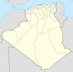
 Map o Algerie heichlichtin Algiers | |
| Coordinates: 36°42′N 3°13′E / 36.700°N 3.217°E | |
| Kintra | |
| Caipital | Algiers |
| Govrenment | |
| • PPA president | Mr. Mohamed Zaïm (FLN) |
| • Wāli | Mr. Mohamed Kebir Addou |
| Area | |
| • Total | 273 km2 (105 sq mi) |
| Population (2008)[1] | |
| • Total | 2,947,461 |
| • Density | 11,000/km2 (28,000/sq mi) |
| Time zone | UTC+01 (CET) |
| Aurie Code | +213 (0) 21 |
| ISO 3166 code | DZ-16 |
| Destricts | 13 |
| Municipalities | 57 |
Admeenistrative diveesions
eeditAlgiers province is dividit intae 13 destricts an 57 communes or municipalities.
Destricts
eeditThe deestricts, leetit accordin tae offeecial numberin (frae wast tae east), are: Zeralda est une commune de la wilaya d'Alger située à 29 km à l'ouest d'Alger-Centre. C'est une commune à vocation agricole et touristique puisqu'elle possède 5 km de plage.
|
1. Zéralda |
8. Sidi M'Hamed |
|
Communes
eeditThe communes, leetit alphabetically, are:
- Alger Centre
- Aïn Bénian
- Aïn Taya (Ain-Taya)
- Bab El Oued
- Bab Ezzouar
- Baba Hassen
- Bachdjerrah (Bach Djerrah)
- Baraki
- Ben Aknoun
- Bir Mourad Raïs
- Birkhadem (Bir Khadem)
- Birtouta
- Bologhine (Bouloghine)
- Bordj El Bahri
- Bordj El Kiffan (Bordj El Kifan)
- Bourouba
- Bouzaréah
- Béni Messous
- Casbah
- Chéraga
- Dar El Beïda
- Douéra
- Draria
- Dély Ibrahim (Dely Brahim)
- El Achour
- El Biar
- El Harrach
- El Madania
- El Magharia
- El Marsa
- El Mouradia
- Gué de Constantine
- H'raoua
- Hammamet
- Hussein Dey
- Hydra
- Khraïcia
- Kouba
- Les Eucalyptus
- Mahelma
- Mohamed Belouizdad
- Mohammedia
- Oued Koriche
- Oued Smar
- Ouled Chebel
- Ouled Fayet
- Rahmania
- Raïs Hamidou
- Reghaïa
- Rouïba
- Saoula
- Sidi M'Hamed (Sidi Mhamed)
- Sidi Moussa
- Souidania
- Staouéli
- Tessala El Merdja
- Zéralda
References
eedit- ↑ Office National des Statistiques, Recensement General de la Population et de l’Habitat 2008 Preliminary results of the 2008 population census. Accessed on 2008-07-02.
| Wikimedia Commons haes media relatit tae Algiers Province. |