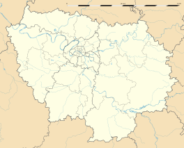
Vernou-la-Celle-sur-Seine
Vernou-la-Celle-sur-Seine is a commune in the Seine-et-Marne depairtment in the Île-de-Fraunce region in north-central Fraunce.
Vernou-la-Celle-sur-Seine | |
|---|---|
| Coordinates: 48°23′16″N 2°50′47″E / 48.3878°N 2.8464°ECoordinates: 48°23′16″N 2°50′47″E / 48.3878°N 2.8464°E | |
| Kintra | Fraunce |
| Region | Île-de-France |
| Depairtment | Seine-et-Marne |
| Arrondissement | Fontainebleau |
| Canton | Moret-sur-Loing |
| Intercommunality | Moret Seine et Loing |
| Govrenment | |
| • Mayor (2008–2014) | Michel Demars |
| Area 1 | 22.42 km2 (8.66 sq mi) |
| Population (2006)2 | 2,716 |
| • Density | 120/km2 (310/sq mi) |
| Time zone | UTC+1 (CET) |
| • Summer (DST) | UTC+2 (CEST) |
| INSEE/Postal code | 77494 /77670 |
| Elevation | 42–145 m (138–476 ft) |
| 1 French Laund Register data, that excludes lochs, ponds, glaciers > 1 km² (0.386 sq mi or 247 acres) an river estuaries. 2 Population withoot dooble coontin: residents o multiple communes (e.g., students an militar personnel) anerly coontit ance. | |
Demographics
eeditInhabitants o Vernou-la-Celle-sur-Seine are cried Vernoucellois.
Biggins
eeditThe notable biggins o the commune include the Château d'Argeville.
See an aw
eeditReferences
eeditFreemit airtins
eedit- Offeecial steid Archived 2020-12-02 at the Wayback Machine (in French)
- 1999 Land Use, from IAURIF (Institute for Urban Planning and Development of the Paris-Île-de-France région) Archived 2007-09-29 at the Wayback Machine (in Inglis)
- French Ministry of Culture list for Vernou-la-Celle-sur-Seine (in French)
- Map of Vernou-la-Celle-sur-Seine on Michelin Archived 2013-01-14 at Archive.today (in Inglis)

