Springfield, Massachusetts
The "Scots" that wis uised in this airticle wis written bi a body that haesna a guid grip on the leid. Please mak this airticle mair better gin ye can. |
Springfield is a ceety in wastren New England, an the seat o Hampden Coonty, Massachusetts, in the Unitit States.[9] Springfield sits on the eastren bank o the Connecticut River near its confluence wi three rivers: the wastren Westfield River, the eastren Chicopee River, an the eastren Mill River. As o the 2010 Census, the ceety's population wis 153,060.[7] Metropolitan Springfield, as ane o twa metropolitan auries in Massachusetts (the ither bein Greater Boston), haed an estimatit population o 698,903 as o 2009.[8]
Springfield, Massachusetts | |
|---|---|
Ceety | |
| City of Springfield | |
 | |
| Eik-name(s): | |
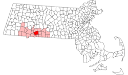
 Location in Hampden Coonty in Massachusetts | |
| Coordinates: 42°06′05″N 72°35′25″W / 42.10139°N 72.59028°W | |
| Kintra | Unitit States |
| State | Massachusetts |
| Coonty | Hampden |
| Settled | 14 Mey 1636 |
| Incorporatit | 1852 |
| Foondit bi | William Pynchon |
| Govrenment | |
| • Teep | Mayor-cooncil ceety |
| • Mayor | Domenic Sarno (D) |
| Area | |
| • Ceety | 86.0 km2 (33.2 sq mi) |
| • Laund | 83.1 km2 (32.1 sq mi) |
| • Water | 2.9 km2 (1.1 sq mi) |
| Elevation | 21 m (70 ft) |
| Population (2010)[7] | |
| • Ceety | 153,060 |
| • Density | 1841.9/km2 (4768.2/sq mi) |
| • Metro | 698,903 |
| Time zone | UTC-5 (Eastren) |
| • Summer (DST) | UTC-4 (Eastren) |
| ZIP code | 01101, 01103–01105, 01107–01109, 01119, 01128–01129, 01151 |
| Area code(s) | 413 |
| FIPS code | 25-67000 |
| GNIS featur ID | 0609092 |
| Website | www |
Notes an references
eeditNotes
eeditReferences
eedit- ↑ "The City of Progress New City Library, Merrick Park, State Street Springfield, MA". Cardcow.com.
- ↑ "The City Of Progress, Winchester Square Springfield, MA". Cardcow.com.
- ↑ Denis Larionov & Alexander Zhulin. "Progressive Springfield, Massachusetts by George Storrs Graves". Ebooksread.com. Archived frae the original on 12 October 2012. Retrieved 13 Mey 2016.
- ↑ "Picturesque Springfield and West Springfield, Massachusetts". Archive.org. Retrieved 27 December 2011.
- ↑ a b "Progressive Springfield, Massachusetts". Archive.org. Retrieved 27 December 2011.
- ↑ "Picturesque Springfield and West Springfield, Massachusetts". Archive.org. Retrieved 27 December 2011.
- ↑ a b "Population and Housing Occupancy Status: 2010 – State – County Subdivision, 2010 Census Redistricting Data (Public Law 94-171) Summary File". U.S. Census Bureau. Retrieved 23 Mairch 2011.
- ↑ a b July 1, 2009, estimated: "Table 1. Annual Estimates of the Population of Metropolitan and Micropolitan Statistical Areas: April 1, 2000 to July 1, 2009 (CBSA-EST2009-01)" (CSV). 2009 Population Estimates. United States Census Bureau, Population Division. 23 Mairch 2010. Retrieved 29 Mairch 2010.
- ↑ "Find a County". National Association of Counties. Retrieved 7 Juin 2011.
Further readin
eedit- Swift, Esther M. (1969). West Springfield Massachusetts: A Town History. West Springfield Heritage Association. OCLC 69843.
- Atlas of Springfield City, Massachusetts. Boston, Massachusetts: Geo. H. Walker & Co. 1882.
Freemit airtins
eedit| Wikimedia Commons haes media relatit tae Springfield, Massachusetts. |
Travel guide tae Springfield, Massachusetts frae Wikivoyage
| Wikisource haes the text o a 1911 Encyclopædia Britannica airticle about Springfield, Massachusetts. |
- City of Springfield, Massachusetts offeecial ceety wabsteid
- Greater Springfield Convention and Visitors Bureau
Coordinates: 42°06′45″N 72°32′51″W / 42.112411°N 72.547455°W

