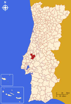
Santarém, Portugal
Santarém (Portuguese pronunciation: [sɐ̃tɐˈɾɐ̃j]) is a ceety an a municipality locatit in the destrict o Santarém in Portugal. The population in 2011 wis 61,752,[1][2] in a aurie o 552.54 km².[3][2] The population o the ceety proper wis 28,760 in 2001.[4]
Santarém | |
|---|---|
 Cabaças touer, umwhile pairt o the ceety's fortifications. | |
 | |
| Kintra | |
| Region | Alentejo |
| Subregion | Lezíria do Tejo |
| Intermunic. comm. | Lezíria do Tejo |
| Destrict | Santarém |
| Pairishes | 18 |
| Govrenment | |
| • Preses | Ricardo Gonçalves (PSD) |
| Area | |
| • Total | 552.54 km2 (213.34 sq mi) |
| Population (2011) | |
| • Total | 61,752 |
| • Density | 110/km2 (290/sq mi) |
| Time zone | WET/WEST (UTC+0/+1) |
| Coordinates | 39°14′N 08°41′W / 39.233°N 8.683°WCoordinates: 39°14′N 08°41′W / 39.233°N 8.683°W |
| Website | http://www.cm-santarem.pt |
Pairishes
eedit- Abitureiras
- Abrã
- Achete
- Alcanede
- Alcanhões
- Almoster
- Amiais de Baixo
- Arneiro das Milhariças
- Azoia de Baixo
- Azoia de Cima
- Casével
- Gançaria
- Moçarria
- Pernes
- Pombalinho
- Póvoa da Isenta
- Póvoa de Santarém
- Romeira
- Marvila
- São Nicolau
- São Salvador
- Santa Iria da Ribeira de Santarém
- São Vicente do Paúl
- Tremês
- Vale de Figueira
- Vale de Santarém
- Vaqueiros
- Várzea
References
eedit- ↑ Instituto Nacional de Estatística
- ↑ a b excluding the parish Pombalinho, that changed from the municipality of Santarém to Golegã in 2013
- ↑ "Direção-Geral do Território". Archived frae the original on 29 September 2014. Retrieved 5 Februar 2015.
- ↑ UMA POPULAÇÃO QUE SE URBANIZA, Uma avaliação recente - Cidades, 2004 Archived 2014-10-06 at the Wayback Machine Nuno Pires Soares, Instituto Geográfico Português (Geographic Institute of Portugal)
Freemit airtins
eedit- Municipality offeecial wabsteid Archived 2020-11-18 at the Wayback Machine
- Santarém Digital

