Mount Everest
(Reguidit frae Munt Everest)
Mount Everest (cryed in Nepal as Sagarmatha an in Tibet as Chomolungma) is the Warld's heichmaist mountain.
| Mount Everest | |
|---|---|
| सगरमाथा (Sagarmāthā) ཇོ་མོ་གླང་མ (Chomolungma) 珠穆朗玛峰 (Zhūmùlǎngmǎ Fēng) | |
 Wastren side o Mount Everest | |
| Heichest pynt | |
| Elevation | 8,848 m (29,029 ft) [1] Ranked 1st |
| Prominence | 8,848 m (29,029 ft) Ranked 1st (Notice special definition for Everest) |
| Isolation | 40,008 kilometre (24,860 mi) |
| Leetin | Seiven Summits Aicht-thoosander Kintra heich pynt Ultra |
| Coordinates | 27°59′17″N 86°55′31″E / 27.98806°N 86.92528°ECoordinates: 27°59′17″N 86°55′31″E / 27.98806°N 86.92528°E [2] |
| Geografie | |
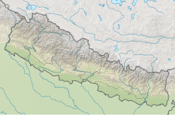
| Location | Solukhumbu Destrict, Sagarmatha Zone, Nepal; Tingri Coonty, Shigatse Prefectur, Tibet Autonomous Region, Cheenae[3] |
| Parent range | Mahalangur Himal, Himalayas |
| Climbing | |
| First ascent | 29 Mey 1953 Edmund Hillary an Tenzing Norgay (First Winter Ascent 1980 Leszek Cichy an Krzysztof Wielicki[4][5]) |
| Easiest route | Sooth Col (Nepal) |
References
eedit- ↑ Based on the 1999 an 2005 surveys o elevation o snaw cap, nae rock heid.
- ↑ The WGS84 coordinates gien here wur calculatit uisin detailed topographic cairttin an are in agreement wi adventurestats Archived 2014-01-08 at the Wayback Machine. Thay are unlikly tae be in error bi mair nor 2". Coordinates shawin Everest tae be mair nor a minute further east that appeared on this page till recently, an still appear in Wikipaedia in several ither leids, are incorrect.
- ↑ The position o the summit o Everest on the internaitional border is clearly shawn on detailed topographic cairttin, includin offeecial Nepalese cairttin.
- ↑ Starr, Daniel (18 Mairch 2011). "Golden Decade: The Birth of 8000 m Winter Climbing". Alpinist.com. Retrieved 28 Mey 2013.
- ↑ "Mt Everest History and facts". Mnteverest.net. Retrieved 29 Mey 2013.
