Mañaria
Mañaria (baith in Basque an Spaingie) is a elizate, toun an municipality locatit in the province o Biscay, in the Basque Kintra, Spain. Mañaria is pairt o the comarca o Durangaldea an haes a population o 459 inhabitants as o 2006 accordin tae the Spaingie Naitional Stateestics Institute.
Mañaria | |
|---|---|
 Mañaria owerview, the quarry in the richt | |
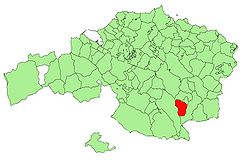
 Location o Mañaria in Biscay. | |
| Kintra | |
| Autonomous commonty | |
| Province | Biscay |
| Comarca | Durangaldea |
| Govrenment | |
| • Mayor | Endika Jayo Bilbao (Bildu) |
| Area | |
| • Total | 17,73 km2 (685 sq mi) |
| Elevation | 259 m (850 ft) |
| Population (2006) | |
| • Total | 459 |
| • Density | 0.26/km2 (0.67/sq mi) |
| Demonym(s) | Mañaritarra |
| Time zone | UTC+1 (CET) |
| • Summer (DST) | UTC+2 (CEST) |
| Postal code | 48212 |
| Website | Offeecial wabsteid |
History
eeditAs happens wi maist o the elizates, little is kent aboot the early history o the toun an its foondation. Prehistoric deposits o Magdalenian an Neolithic oreegin hae been foond in the caves o Silibranka, Kobazar an Atxuri, amang ithers. A Visigoth liturgical vase o the 7t hunderyear haes been foond an aw.
Mañaria wis pairt o the merindad o Durango, an it haed voice an richt tae vote in the Juntas o Guerendiaga, whaur it occupee'd the seat nummer fower. On the 18t hunderyear the construction o the Ryal Road connectin the ceety o Vitoria wi the coast o Biscay goin throu Urkiola meant the realignment o the toun's location, makkin it the central axis o the municipality. Syne mid 18t hunderyear an durin the entire 19t hunderyear, Mañaria livit a period o splendor acause o the exploitation of its quarries. The kirk is extendit, an the schuil, the Basque pelota fronton, the touer o the clock an the cemetery are built.
Geografie
eeditLocation
eeditMañaria is locatit in the sootheastren pairt o the province o Biscay, which is locatit in northern Spain. It limits at north wi the municipalities o Izurtza an Durango, at wast wi Dima an at east an sooth wi Abadiño.
Mañaria is situatit on a valley athin the course o the Mañaria River and surroondit bi muntains; the Mugarra an Untxillaitz the maist significant anes. Ither important muntains that surroond the municipality are the Arrietabaso an Saibi. The road BI-623 that connects Durango wi Vitoria-Gasteiz crosses the ceety frae north tae sooth afore ascendin tae Urkiola. Mair nor 70% o the territory o the municipality is pairt o the Urkiola Naitural Pairk.
Hydrografie
eeditThe valley is shapit bi the Mañaria River that oreeginates in the hillsides o the muntains that surroond it. This river later jyns the Ibaizabal river.
Economy
eeditThe economy o the municipality is based on minin an industry.
Primar Sector
eeditThe primar sector is based on the exploitation o resources as limestane an marble in quarries, bein this the main economical activity o the municipality. Some smaw fermin activities are present an aw.
Seicondar Sector
eeditThe seicondar sector is based on the metallurgical transformation. Maist o the industries are locatit in the deeper aurie o the valley.
Tertiar Sector
eeditIt is amaist nan-existent due tae the proximity o bigger ceeties, as Durango or Bilbao, whaur maist o the services are locatit.
Transportation
eeditThe transportation is based on road transportation bi the BI-623 road, which connects the toun wi Durango, the caipital ceety o the comarca o Durangaldea an 5 km awa. The same road bi sooth connects the toun wi Urkiola an frae thare tae Otxandio, Dima an the province o Álava. In Durango, the road is connectit tae the Naitional Road N-634 an the heich-gate AP-8 tae Bilbao an Donostia-San Sebastián.

