File:Location Khan Yunis.png

Size o this luikower: 563 × 600 pixels. Ither resolutions: 225 × 240 pixels | 600 × 639 pixels.
Oreeginal file (600 × 639 pixels, file size: 38 KB, MIME type: image/png)
| Descreeption |
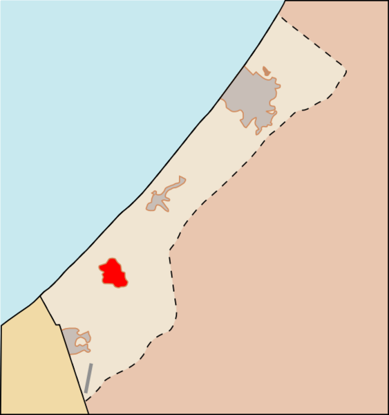
العربية: خان يونس
English: Locator map of the city of Khan Yunis — in the southern Gaza Strip of the Palestinian territories.
עברית: ח'אן יונס
|
| Date | (UTC) |
| Soorce | Gaza_Strip_map_el.svg |
| Author |
|
This file is licensed under the Creative Commons Attribution 3.0 Unported license.
- Ye are free:
- tae share – tae copy, distribute an transmit the wirk
- tae remix – tae adapt the wirk
- Unner the follaein condeetions:
- attribution – Ye must attribute the wirk in the manner specified bi the author or licensor (but nae in ony way that suggests that thay endorse ye or yer uise o the wirk).
File history
Clap oan ae date/time fer tae see the file aes it kithed at that time.
| Date/Time | Thummnail | Dimensions | Uiser | Comment | |
|---|---|---|---|---|---|
| current | 17:48, 13 Januar 2009 | | 600 × 639 (38 KB) | Geraki | {{Information |Description={{el|1=Χάρτης με την θέση της Χαν Γιουνίς στην Λωρίδα της Γάζα.}} {{en|1=Location of [[:en:Khan Yunis|Khan Yunis] |
Eimage airtins
The follaein pages airts tae this image:
Global file uisage
The follaein ither wikis uise this file:
- Uisage on ar.wikipedia.org
- Uisage on et.wikipedia.org
- Uisage on ja.wikipedia.org
- Uisage on pt.wikipedia.org
- Uisage on tr.wikipedia.org
- Uisage on ur.wikipedia.org