File:Greenland edcp relief location map.jpg

Size o this luikower: 424 × 599 pixels. Ither resolutions: 170 × 240 pixels | 340 × 480 pixels | 543 × 768 pixels | 1,181 × 1,669 pixels.
Oreeginal file (1,181 × 1,669 pixels, file size: 1.26 MB, MIME type: image/jpeg)
Ootline
| Descreeption |
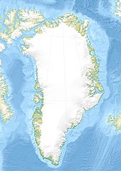
English: Relief location map of Greenland.
|
| Date | |
| Soorce | Ain wirk |
| Author | Uwe Dedering |
| Other versions |
|


Licensin
I, the copyright holder of this work, hereby publish it under the following licenses:
This file is licensed unner the Creative Commons Attribution-Share Alike 3.0 Unported license.
- Ye are free:
- tae share – tae copy, distribute an transmit the wirk
- tae remix – tae adapt the wirk
- Unner the follaein condeetions:
- attribution – Ye must attribute the wirk in the manner specified bi the author or licensor (but nae in ony way that suggests that thay endorse ye or yer uise o the wirk).
- share alik – If ye alter, transform, or big upon this wirk, ye mey distribute the resultin wirk anly unner the same or seemilar license tae this ane.

|
Permission is grantit tae copy, distribute an/or modify this document unner the terms o the GNU Free Documentation License, Version 1.2 or ony later version published bi the Free Software Foundation; wi no Invariant Sections, no Front-Cover Texts, an no Back-Cover Texts. A copy o the license is includit in the section enteetled GNU Free Documentation License. |
Ye mey select the license o yer choice.
File history
Clap oan ae date/time fer tae see the file aes it kithed at that time.
| Date/Time | Thummnail | Dimensions | Uiser | Comment | |
|---|---|---|---|---|---|
| current | 16:09, 1 December 2010 | | 1,181 × 1,669 (1.26 MB) | Uwe Dedering | {{Information |Description={{en|1= Relief location map of Greenland. * Projection: EquiDistantConicProjection. * Area of interest: :* N: 85.0° N :* S: 59.0° N :* W: -75.0° E :* E: -10.0° E * Projection center: :* NS: 72.0° N :* WE: -42.5° E *Standar |
Eimage airtins
The follaein pages airts tae this image:
Global file uisage
The follaein ither wikis uise this file:
- Uisage on ast.wikipedia.org
- Uisage on az.wikipedia.org
- Qrenlandiya adası
- Qrenland dənizi
- Şablon:Yer xəritəsi Danimarka Qrenlandiya
- Baffin dənizi
- Devis boğazı
- Danimarka boğazı
- Linkoln dənizi
- Vandel dənizi
- Nares boğazı
- Fram (boğaz)
- İrminger dənizi
- Disko boğazı (körfəz)
- Piri Torpağı
- Disko adası
- Morris Cesup burnu
- ATOW1996
- Ella adası
- Şannon adası
- Ammassalik adası
- İmer adası
- Toyfelşloss dağı
- İllorsuit adası
- Uummannak fiordu
- Skorsbi körfəzi
- Coğrafiya Cəmiyyəti adası
- Store Koldevey adası
- Hans adası
- Uunartoq Qeqertoq
- Qunbyorn dağı
- Aleksandr burnu (Qrenlandiya)
- York burnu (Qrenlandiya)
- Farvel burnu
- Nordostrunningen burnu
- Nuussuaq yarımadası
- Uisage on ba.wikipedia.org
- Uisage on bcl.wikipedia.org
- Uisage on be-tarask.wikipedia.org
- Uisage on be.wikipedia.org
- Uisage on bg.wikipedia.org
View mair global usage o this file.