Deir al-Balah
Deir el-Balah or Dayr al-Balah (Arabic: دير البلح) is locatit in the central Gaza Strip an is the caipital or muhfaza (seat) o the Deir el-Balah Govrenorate. Accordin tae the Palestinian Central Bureau o Statistics, the ceety haed a population o 49,751 in mid-year 2006.[1][2]
Deir al-Balah | |
|---|---|
| Ither transcription(s) | |
| • Arabic | دير البلح |
| • An aa spelled | Deir el-Balah (official) Dayr al-Balah (unofficial) |
 Skyline o Deir al-Balah, 2008 | |
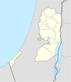
Location o Deir al-Balah within the Palestinian territories | |
| Coordinates: 31°25′08″N 34°21′06″E / 31.41889°N 34.35167°ECoordinates: 31°25′08″N 34°21′06″E / 31.41889°N 34.35167°E | |
| Palestine grid | 088/092 |
| Govrenorate | Deir al-Balah |
| Foondit | 14t century BC |
| Govrenment | |
| • Teep | Ceety (from 1994) |
| • Heid o Municipality | Sa'ed Nassar |
| Area | |
| • Jurisdiction | 14.7 km2 (5.7 sq mi) |
| Population (2007) | |
| • Jurisdiction | 54,439 |
| Name meanin | "Monastery o the Date Palm" |
Well-kent for its beaches an date palms, recent aircheological excavations uncovered a cemetery datin back tae the late Bronze Age filled wi pottery, tombs, bronze pots an a mosaic floor. Deir al-Balah an aw contains a monastery biggit bi St. Helena in 372 AD.
Mayors
eedit- Ahmad Kurd
- Sami Abu Salim
Notes
eedit- ↑ Projected Mid -Year Population Archived 2011-05-19 at the Wayback Machine for Deir al Balah Governorate by Locality 2004- 2006 Palestinian Central Bureau of Statistics
- ↑ Profile: Gaza Strip, BBC News Online, 27 June 2006, accessed 8 May 2007.
Freemit airtins
eedit- Map of the Deir-al Balah Governorate Archived 2007-09-29 at the Wayback Machine

