Uttarakhand
Uttarakhand/ˌᵿtərɑː khənd/, umwhile Uttaranchal, is a state in the northren pairt o Indie. It is aften referred tae as the "Land o the gods" due tae the mony holy Hindu temples an pilgrimage centres foond throughoot the state. Kent for its natural brawnnie o the Himalayas, the Bhabhar an the Terai, the state wis carvit oot o the Himalayan an adjoinin northwastren destricts o Uttar Pradesh on 9 November 2000, becomin the 27t state o the Republic o Indie.[3] The state is dividit intae twa diveesions, Kumaon an Garhwal, wi a total o 13 destricts. The proveesional caipital of Uttarakhand is Dehradun, which is a railhead an the lairgest ceety in the region an aw. The heich court o the state is in Nainital.
Uttarakhand | |
|---|---|
 Location o Uttarakhand in Indie | |
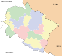
 Map o Uttarakhand | |
| Coordinates (Dehradun): 30°20′N 78°04′E / 30.33°N 78.06°E | |
| Kintra | Indie |
| Established | 9 November 2000 |
| Caipital | Dehradun† |
| Lairgest ceety | Dehradun |
| Destricts | 13 |
| Govrenment | |
| • Govrenor | Aziz Qureshi |
| • Chief Meenister | Vijay Bahuguna (INC) |
| • Legislature | Unicameral (70 seats) |
| • Parliamentary constituency | 5 |
| • Heich Court | Uttarakhand Heich Court |
| Area | |
| • Total | 53,566 km2 (20,682 sq mi) |
| Area rank | 18th |
| Population (2011) | |
| • Total | 10,116,752 |
| • Rank | 19t |
| • Density | 189/km2 (490/sq mi) |
| Time zone | UTC+05:30 (IST) |
| ISO 3166 code | IN-UT |
| HDI | 0.515[1] |
| HDI rank | 7t (2011) |
| Literacy | 79.63% |
| Sex ratio | 963 |
| Leids spoken | Garhwali, Kumaoni, Hindi, Urdu |
| Offeecial leids | Hindi, Sanskrit |
| Website | uk.gov.in |
| ^† Dehradun is the proveesional caipital o the state. The new caipital haes no yet been chosen. | |
References eedit
- ↑ "Inequality- adjusted Human Development Index for India's States-2011" (PDF). United Nations Development Programme. Archived frae the original (PDF) on 1 Mairch 2013. Retrieved 17 Julie 2012.
- ↑ http://www.harbanskapoor.com
- ↑ "About Us". Government of Uttarakhand. Retrieved 17 Julie 2012.
Freemit airtins eedit
| Wikimedia Commons haes media relatit tae Uttarakhand. |
- Govrenment
- Ither
- Travel guide tae Uttarakhand frae Wikivoyage
- Uttarakhand at Curlie