Moont Rainier
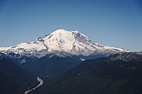
Moont Rainier (pronoonced: /reɪˈnɪər/) is the heicchest mountain o the Cascade Range o the Paceefic Northwast, an the heichest moontain in the state o Washington.
| Moont Rainier | |
|---|---|
 Moont Rainier as viewed frae the northeast. | |
| Heichest pynt | |
| Elevation | 14,411 ft (4,392 m) NGVD 29[1][2] |
| Prominence | 13,211 ft (4,027 m) [3] Ranked 21st[4] |
| Isolation | 1,177 kilometre (731 mi) |
| Leetin | U.S. state heich pynt Ultra Decade Volcano |
| Coordinates | 46°51′10″N 121°45′37″W / 46.8528857°N 121.7603744°WCoordinates: 46°51′10″N 121°45′37″W / 46.8528857°N 121.7603744°W [5] |
| Geografie | |
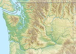
| State/Province | US-WA |
| Parent range | Cascade Range |
| Topo map | USGS Moont Rainier Wast |
| Geology | |
| Age o rock | 500,000 years |
| Muntain teep | Stratovolcano |
| Volcanic arc | Cascade Volcanic Arc |
| Last eruption | November tae December 1894[6] |
| Climbing | |
| First ascent | 1870 bi Hazard Stevens an P. B. Van Trump |
| Easiest route | rock/ice climb via Disappointment Cleaver |
References
eedit- ↑ Hill, Craig (16 November 2006). "Taking the measure of a mountain". The News Tribune. Archived frae the original on 16 November 2006.
- ↑ Signani, PLS, Larry (19 Julie 2000). "The Height of Accuracy". Point of Beginning (trade magazine). BNP Media. Archived frae the original on 27 Apryle 2012. Retrieved 17 October 2008.
- ↑ "World Top 50 by Prominence". Peakbagger.com. Retrieved 5 November 2008.
- ↑ "Mount Rainier". Peakbagger.com.
- ↑ "Mount Rainier". Geographic Names Information System. United States Geological Survey. Retrieved 15 October 2008.
- ↑ "Rainier". Global Volcanism Program. Smithsonian Institution. Retrieved 27 August 2008.
