Moont Elbrus
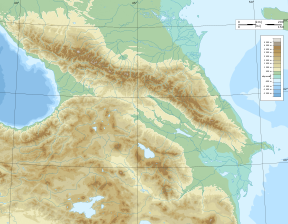
Moont Elbrus (Roushie: Эльбру́с, romanised: El'brus, lit. 'ɪlʲˈbrus'; [Минги тау, Min̡i taw] error: {{lang-xx}}: text has italic markup (help), IPA: [miŋŋi taw] (![]() listen)) is a dormant volcano locatit in the wastren Caucasus moontains, in Kabardino-Balkarie an Karachay–Cherkessia o Roushie, near the border wi Georgie.
listen)) is a dormant volcano locatit in the wastren Caucasus moontains, in Kabardino-Balkarie an Karachay–Cherkessia o Roushie, near the border wi Georgie.
| Moont Elbrus | |
|---|---|
 Moont Elbrus | |
| Heichest pynt | |
| Elevation | 5,642 m (18,510 ft) [1][2] |
| Prominence | 4,741 m (15,554 ft) Ranked 10t |
| Isolation | 2,473 kilometre (1,537 mi) |
| Leetin | Seven Summits Volcanic Seven Summits Kintra heich pynt Ultra |
| Coordinates | 43°21′18″N 42°26′21″E / 43.35500°N 42.43917°ECoordinates: 43°21′18″N 42°26′21″E / 43.35500°N 42.43917°E |
| Geografie | |
| Location | Russia |
| Parent range | Caucasus Moontains |
| Topo map | Elbrus an Upper Baksan Valley bi EWP[3][4] |
| Geology | |
| Age o rock | Unknown |
| Muntain teep | Stratovolcano (dormant) |
| Last eruption | 50 CE ± 50 years[5] |
| Climbing | |
| First ascent | (West summit) 1874, by Florence Crauford Grove, Frederick Gardner, Horace Walker and the guides Peter Knubel of St. Niklaus in the canton Valais and Ahiya Sottaiev (Lower summit) 22 July 1829 by karachay guide Khillar Khachirov |
| Easiest route | Basic snow/ice climb |
References
eedit- ↑ The World Book Encyclopedia—Page 317 by World Book, Inc
- ↑ Mt. Elbrus : Image of the Day. Earthobservatory.nasa.gov. Retrieved on 15 May 2014.
- ↑ Mount Elbrus Map Sample. Ewpnet.com. Retrieved on 15 May 2014.
- ↑ Mount Elbrus and Upper Baksan Valley Map and Guide (Map) (2nd ed.). 1:50,000 with mountaineering information. EWP Map Guides. Cartografie bi EWP. EWP. 2007. ISBN 978-0-906227-95-4.
- ↑ "Elbrus: Summary". Global Volcanism Program. Smithsonian Institution. Archived frae the original on 17 Februar 2013. Retrieved 25 Februar 2010.
