Lomas del Mirador
Lomas del Mirador is a locality o the La Matanza partido in Greater Buenos Aires. Locatit ootside Buenos Aires alang the soothwast edge o the General Paz Freeway, the ceety haes a population o 51,488 (INDEC, 2001).
Lomas del Mirador | |
|---|---|
Toun | |
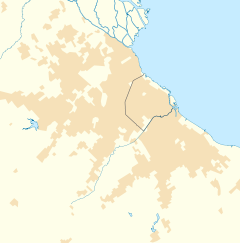
Location in Greater Buenos Aires | |
| Coordinates: 34°40′00″S 58°31′47″W / 34.66667°S 58.52972°WCoordinates: 34°40′00″S 58°31′47″W / 34.66667°S 58.52972°W | |
| Kintra | |
| Province | Buenos Aires |
| Partido | La Matanza Partido |
| Area | |
| • Total | 5.5 km2 (2.1 sq mi) |
| Elevation | 22 m (72 ft) |
| Population | |
| • Total | 51,488 |
| • Density | 9,400/km2 (24,000/sq mi) |
| CPA Base | B 1752 |
| Area code(s) | +54 011 |
| Website | Municipio de La Matanza: Lomas del Mirador |
The laund whaur Lomas del Mirador is locatit wis sauld bi Ezequiel Ramos Mexía tae Pablo Pelluse in 1868. The ranch at the steid wis kent as Terrenos del Mirador ("the leikoot property") in reference tae the estancia tharein, Mirador Santa Lucía. A neebourin property wis awned bi the stryndants o Govrenor Manuel Dorrego, a key figur in the Argentine Ceevil Wars o the 19t hunderyear, an the ceety shield wad include a red leukoot touer in reference tae baith the toun's name an that faimily's allegiance tae the Federalists durin the ceevil wars.
These properties wur later sauld, an in 1909, the first lots wur parceled tae investors an hamesteiders. It wad later be hame tae a diversifee'd base o licht industry, notably the umwhile Jabón Federal ("Federal Soap") facility. The Provincial Legislatur declared Lomas del Mirador a ceety in 1984.

