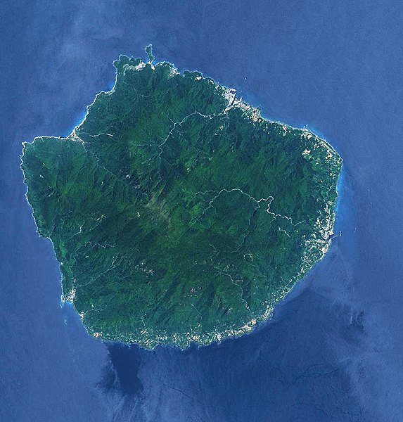
File:Yakushima.jpg

Size o this luikower: 573 × 600 pixels. Ither resolutions: 229 × 240 pixels | 459 × 480 pixels | 734 × 768 pixels | 1,244 × 1,302 pixels.
Oreeginal file (1,244 × 1,302 pixels, file size: 860 KB, MIME type: image/jpeg)
Ootline
| Object location | | View this and other nearby images on: OpenStreetMap |
|---|
Licensin
| This file is in the public domain in the United States because it was solely created by NASA. NASA copyright policy states that "NASA material is not protected by copyright unless noted". (See Template:PD-USGov, NASA copyright policy page or JPL Image Use Policy.) | ||
 |
Warnings:
|
File history
Clap oan ae date/time fer tae see the file aes it kithed at that time.
| Date/Time | Thummnail | Dimensions | Uiser | Comment | |
|---|---|---|---|---|---|
| current | 09:28, 17 Mairch 2016 | | 1,244 × 1,302 (860 KB) | Batholith | color |
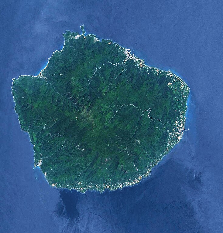
| 13:25, 31 Mairch 2006 |  | 1,244 × 1,302 (113 KB) | Jugger90 | landsat image of Yakushima. taken on May 25,2002 |
Eimage airtins
The'r nae pages airts tae this eimage.
Global file uisage
The follaein ither wikis uise this file:
- Uisage on bn.wikipedia.org
- Uisage on ca.wikipedia.org
- Uisage on cs.wikipedia.org
- Uisage on el.wikipedia.org
- Uisage on en.wikipedia.org
- Uisage on es.wikipedia.org
- Uisage on eu.wikipedia.org
- Uisage on fi.wikipedia.org
- Uisage on fr.wikipedia.org
- Uisage on he.wikipedia.org
- Uisage on hr.wikipedia.org
- Uisage on hy.wikipedia.org
- Uisage on ja.wikipedia.org
- Uisage on jv.wikipedia.org
- Uisage on ko.wikipedia.org
- Uisage on mk.wikipedia.org
- Uisage on ml.wikipedia.org
- Uisage on pl.wikipedia.org
- Uisage on sv.wikipedia.org
- Uisage on uk.wikipedia.org
- Uisage on vi.wikipedia.org
- Uisage on wuu.wikipedia.org
- Uisage on zh-yue.wikipedia.org
- Uisage on zh.wikipedia.org