File:Wales relief location map.jpg
Size o this luikower: 502 × 600 pixels. Ither resolutions: 201 × 240 pixels | 402 × 480 pixels | 643 × 768 pixels | 857 × 1,024 pixels | 2,000 × 2,390 pixels.
Oreeginal file (2,000 × 2,390 pixels, file size: 742 KB, MIME type: image/jpeg)
| Descreeption |
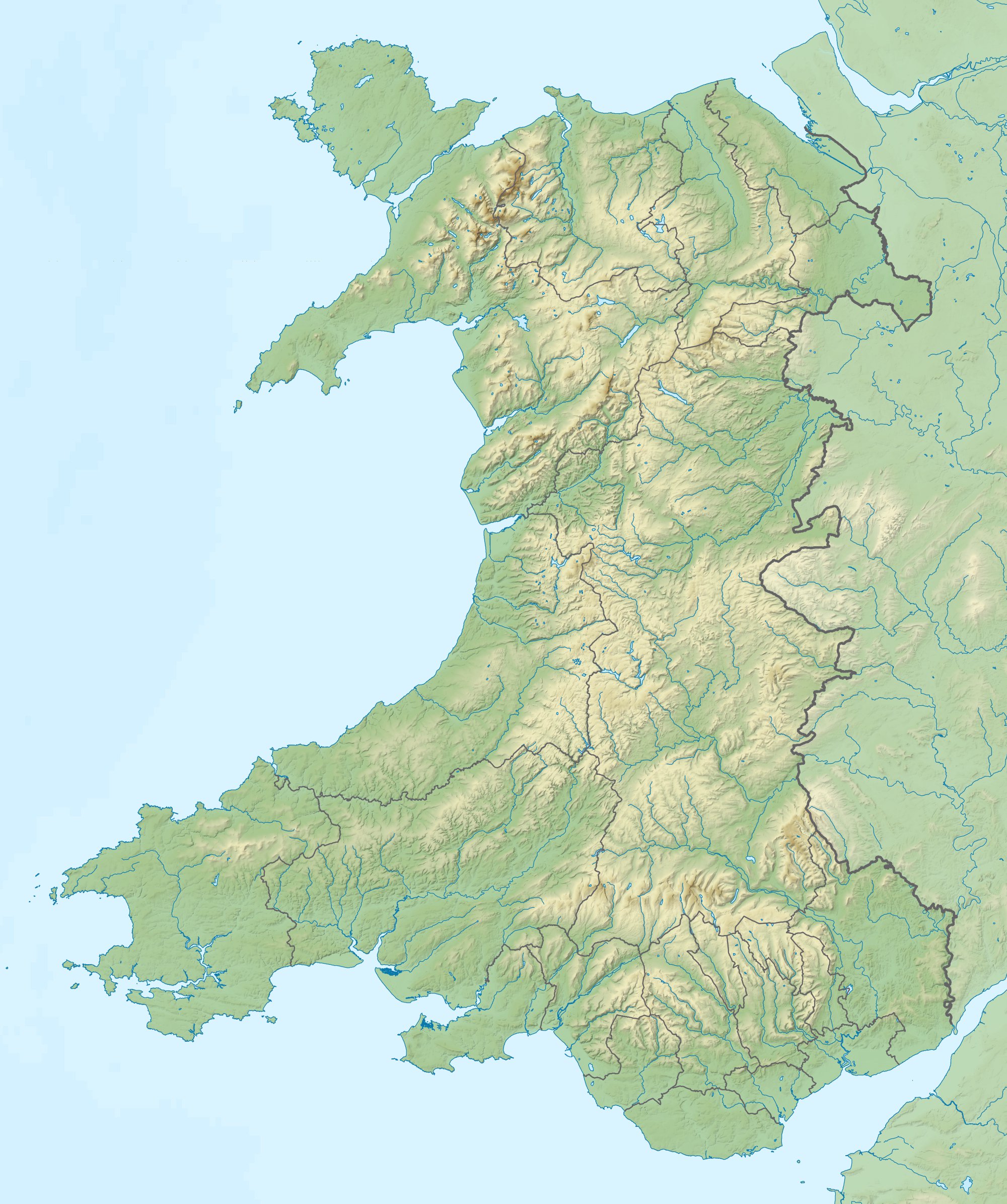
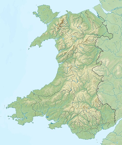
Relief map of Wales, UK. Equirectangular map projection on WGS 84 datum, with N/S stretched 170%
|
| Date | |
| Soorce |
|
| Author | Nilfanion, created using Ordnance Survey data |
| Permission (Reuisin this file) |
This file is licensed unner the Creative Commons Attribution-Share Alike 3.0 Unported license. Attribution: Contains Ordnance Survey data © Crown copyright and database right
|
| Other versions | File:Wales location map.svg - Blank map |
File history
Clap oan ae date/time fer tae see the file aes it kithed at that time.
| Date/Time | Thummnail | Dimensions | Uiser | Comment | |
|---|---|---|---|---|---|
| current | 11:53, 9 December 2011 | | 2,000 × 2,390 (742 KB) | Nilfanion | {{Information |Description=Relief map of Wales, UK. Equirectangular map projection on WGS 84 datum, with N/S stretched 170% *West: 5.5W *East: 2.5W *North: 53.5N *South: 51.3N |Source=Ordnance Survey [https://www.ordnan |
Eimage airtins
The follaein pages airts tae this image:
Global file uisage
The follaein ither wikis uise this file:
- Uisage on ar.wikipedia.org
- Uisage on ast.wikipedia.org
- Uisage on az.wikipedia.org
- Uisage on ba.wikipedia.org
- Uisage on bg.wikipedia.org
- Ланголен
- Кардиф
- Суонзи
- Брекън
- Нюпорт
- Мърдър Тидфил (град)
- Денби
- Тремадог
- Колуин Бей
- Уитфорд
- Бангор (Уелс)
- Сейнт Дейвидс
- Ъск
- Престатин
- Рил
- Коруен
- Карог
- Ридлан
- Ридин
- Сейнт Асаф
- Моулд
- Багилт
- Бъкли
- Ъстрад Мънах
- Кайруис
- Конас Кий
- Юлоу
- Флинт (Уелс)
- Хардън
- Бротън
- Хоулиуел
- Куинсфери
- Солтни
- Шотън
- Чърк
- Рексъм (град)
- Амлух
- Биумарис
- Бенлех
- Хоулихед
- Лангевни
- Менай Бридж
- Абергеле
- Конуи (град)
View mair global usage o this file.