File:USA Virginia Northern location map.svg

Size of this PNG preview of this SVG file: 234 × 297 pixels. Ither resolutions: 189 × 240 pixels | 378 × 480 pixels | 605 × 768 pixels | 807 × 1,024 pixels | 1,613 × 2,048 pixels.
Oreeginal file (SVG file, nominallie 234 × 297 pixels, file size: 51 KB)
Ootline
| Descreeption |
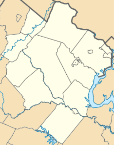
English: Equirectangular projection, N/S stretching 130.0 %. Geographic limits of the map: top=39.324960, bottom=37.990552, left=-78.391863, right=-77.038670. Northern Virginia as defined by the Washington metropolitan area (Alexandria, Arlington County, Clarke County, Culpeper County, Fairfax County, Fairfax, Falls Church, Fauquier County, Loudoun County, Manassas, Manassas Park, Prince William County, Rappahannock County, Spotsylvania County, Stafford County, Fredericksburg, Warren County). |
| Date | |
| Soorce | Ain wirk |
| Author | Id4abel |
| SVG genesis |

Licensin
I, the copyright holder of this work, hereby publish it under the following license:
This file is licensed under the Creative Commons Attribution-Share Alike 4.0 International license.
- Ye are free:
- tae share – tae copy, distribute an transmit the wirk
- tae remix – tae adapt the wirk
- Unner the follaein condeetions:
- attribution – Ye must attribute the wirk in the manner specified bi the author or licensor (but nae in ony way that suggests that thay endorse ye or yer uise o the wirk).
- share alik – If ye alter, transform, or big upon this wirk, ye mey distribute the resultin wirk anly unner the same or seemilar license tae this ane.
File history
Clap oan ae date/time fer tae see the file aes it kithed at that time.
| Date/Time | Thummnail | Dimensions | Uiser | Comment | |
|---|---|---|---|---|---|
| current | 16:27, 26 Juin 2016 | | 234 × 297 (51 KB) | Id4abel | Can't seem to get version with all counties as the current version. |
| 16:24, 26 Juin 2016 |  | 234 × 297 (51 KB) | Id4abel | Reverted to version as of 06:12, 26 June 2016 (UTC) | |
| 16:23, 26 Juin 2016 |  | 234 × 297 (51 KB) | Id4abel | Reverted to version as of 06:11, 26 June 2016 (UTC) | |
| 06:12, 26 Juin 2016 |  | 234 × 297 (51 KB) | Id4abel | Reverted to version as of 06:08, 26 June 2016 (UTC) | |
| 06:11, 26 Juin 2016 |  | 234 × 297 (51 KB) | Id4abel | This version includes Culpeper County and Rappahannock County. | |
| 06:08, 26 Juin 2016 |  | 234 × 297 (51 KB) | Id4abel | This version includes Culpeper County and Rappahannock County. | |
| 22:49, 15 Mey 2016 |  | 234 × 297 (51 KB) | Id4abel | User created page with UploadWizard |
Eimage airtins
The'r nae pages airts tae this eimage.
Global file uisage
The follaein ither wikis uise this file:
- Uisage on ar.wikipedia.org
- Uisage on en.wikipedia.org
- George Mason University
- Winchester, Virginia
- Manassas Park, Virginia
- Manassas, Virginia
- Fredericksburg, Virginia
- Falls Church, Virginia
- Fairfax, Virginia
- Annandale, Virginia
- Bailey's Crossroads, Virginia
- Belle Haven, Fairfax County, Virginia
- Burke, Virginia
- Centreville, Virginia
- Chantilly, Virginia
- Clifton, Virginia
- Dunn Loring, Virginia
- Fort Hunt, Virginia
- Franconia, Virginia
- Great Falls, Virginia
- Groveton, Virginia
- Herndon, Virginia
- Huntington, Virginia
- Hybla Valley, Virginia
- Idylwood, Virginia
- West Falls Church, Virginia
- Lake Barcroft, Virginia
- Lincolnia, Virginia
- Lorton, Virginia
- Mantua, Virginia
- McLean, Virginia
- Merrifield, Virginia
- Mount Vernon, Virginia
- Newington, Virginia
- North Springfield, Virginia
- Oakton, Virginia
- Pimmit Hills, Virginia
- Reston, Virginia
- Rose Hill, Fairfax County, Virginia
- Seven Corners, Virginia
- Springfield, Virginia
- Tysons, Virginia
- Vienna, Virginia
- West Springfield, Virginia
- Wolf Trap, Virginia
- Hamilton, Virginia
- Hillsboro, Loudoun County, Virginia
- Leesburg, Virginia
- Lovettsville, Virginia
- Middleburg, Virginia
View mair global usage o this file.