File:USA Texas location map.svg

Size of this PNG preview of this SVG file: 606 × 600 pixels. Ither resolutions: 243 × 240 pixels | 485 × 480 pixels | 776 × 768 pixels | 1,035 × 1,024 pixels | 2,070 × 2,048 pixels | 1,500 × 1,484 pixels.
Oreeginal file (SVG file, nominallie 1,500 × 1,484 pixels, file size: 695 KB)
Ootline
| Descreeption |
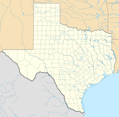
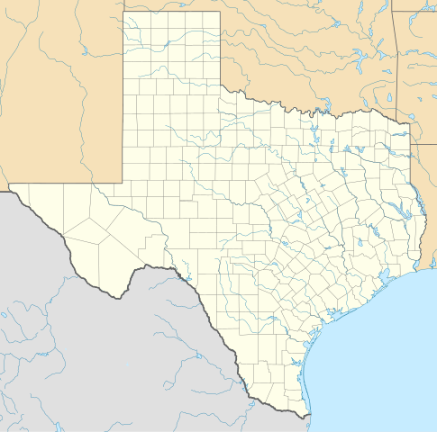
Quadratische Plattkarte, N-S-Streckung 120 %. Geographische Begrenzung der Karte:
Equirectangular projection, N/S stretching 120 %. Geographic limits of the map:
|
| Date | |
| Soorce | Ain wirk |
| Author | Alexrk |
| Other versions |
Derivative works of this file: |

|
This map has been made or improved in the German Kartenwerkstatt (Map Lab). You can propose maps to improve as well.
|
Licensin
I, the copyright holder of this work, hereby publish it under the following licenses:

|
Permission is grantit tae copy, distribute an/or modify this document unner the terms o the GNU Free Documentation License, Version 1.2 or ony later version published bi the Free Software Foundation; wi no Invariant Sections, no Front-Cover Texts, an no Back-Cover Texts. A copy o the license is includit in the section enteetled GNU Free Documentation License. |
This file is licensed under the Creative Commons Attribution 3.0 Unported license.
- Ye are free:
- tae share – tae copy, distribute an transmit the wirk
- tae remix – tae adapt the wirk
- Unner the follaein condeetions:
- attribution – Ye must attribute the wirk in the manner specified bi the author or licensor (but nae in ony way that suggests that thay endorse ye or yer uise o the wirk).
Ye mey select the license o yer choice.
File history
Clap oan ae date/time fer tae see the file aes it kithed at that time.
| Date/Time | Thummnail | Dimensions | Uiser | Comment | |
|---|---|---|---|---|---|
| current | 20:30, 17 Juin 2009 | | 1,500 × 1,484 (695 KB) | Alexrk2 | enh |
| 13:05, 7 Juin 2009 |  | 1,500 × 1,484 (558 KB) | Alexrk | water bodies 1:10mio | |
| 21:43, 6 Juin 2009 |  | 1,500 × 1,484 (850 KB) | Alexrk | GeneralizationDistance = 2px | |
| 17:41, 6 Juin 2009 |  | 1,500 × 1,485 (1.48 MB) | Alexrk | == Beschreibung == {{Information |Description= {{de|Positionskarte von Texas, USA}} Quadratische Plattkarte, N-S-Streckung 120 %. Geographische Begrenzung der Karte: * N: 36.8° N * S: 25.5° N * W: 106.9° W * O: 93.2° W {{en|L |
Eimage airtins
The follaein pages airts tae this image:
Global file uisage
The follaein ither wikis uise this file:
- Uisage on af.wikipedia.org
- Uisage on als.wikipedia.org
- Uisage on an.wikipedia.org
- Uisage on ar.wikipedia.org
- Uisage on ast.wikipedia.org
- Uisage on azb.wikipedia.org
- سایپرس، تکزاس
- ونکورت، تکزاس
- شابلون:Location map Texas
- لوپ، تکزاس
- اوریسن، تکزاس
- لاس پالماس ۲، تکزاس
- قلیدن، تکزاس
- آنیون کریک، آستین، تکزاس
- کوپلند، تکزاس
- ساوانا، تکزاس
- آرویو قاردنز-لاتینا رنچ، تکزاس
- تییرا بونتیا، تکزاس
- لیک مردیت استیتس، تکزاس
- منچاکا، تکزاس
- باوزل اند الیس، تکزاس
- وست پیرسال، تکزاس
- بونانزا هیلز، تکزاس
- تاندربیرد بی، تکزاس
- لاس پالماس، تکزاس
- آریو آلتو، تکزاس
- پینت کریت، تکزاس
- مونتاژ، تکزاس
- پالوما کریک ساوت، تکزاس
- کولورادو ایکرز، تکزاس
- امارقوسا، تکزاس
- لینکلن، تکزاس
- نورتکلیف، تکزاس
View mair global usage o this file.