File:Spain Valencian Community location map.svg

Size of this PNG preview of this SVG file: 442 × 600 pixels. Ither resolutions: 177 × 240 pixels | 353 × 480 pixels | 566 × 768 pixels | 754 × 1,024 pixels | 1,509 × 2,048 pixels | 512 × 695 pixels.
Oreeginal file (SVG file, nominallie 512 × 695 pixels, file size: 538 KB)
Ootline
| Descreeption |
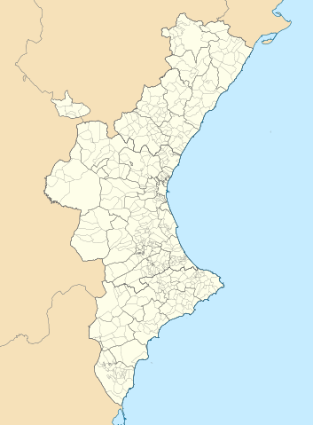
Català: Mapa de localització del País Valencià
Projecció equirrectangular, N/S estirada 130 %. Extrems geogràfics al mapa:
English: Location map of the Land of Valencia
Equirectangular projection, N/S stretching 130 %. Geographic limits of the map:
Español: Mapa de localización de la Comunidad Valenciana
Proyección equirrectangular, N/S estirada 130 %. Límites geográficos del mapa:
|
|
| Date | ||
| Soorce | Own work based on: EspañaLoc.svg by HansenBCN, and Own work based on: Mapa de localització a les comarques valencianes.svg by Martorell | |
| Author | Miguillen and Martorell | |
| SVG genesis | This locator map was created with Inkscape.
|
Licensin
Miguillen, the copyright holder of this work, hereby publishes it under the following license:
This file is licensed unner the Creative Commons Attribution-Share Alike 3.0 Unported license.
Attribution: Miguillen
- Ye are free:
- tae share – tae copy, distribute an transmit the wirk
- tae remix – tae adapt the wirk
- Unner the follaein condeetions:
- attribution – Ye must attribute the wirk in the manner specified bi the author or licensor (but nae in ony way that suggests that thay endorse ye or yer uise o the wirk).
- share alik – If ye alter, transform, or big upon this wirk, ye mey distribute the resultin wirk anly unner the same or seemilar license tae this ane.
File history
Clap oan ae date/time fer tae see the file aes it kithed at that time.
| Date/Time | Thummnail | Dimensions | Uiser | Comment | |
|---|---|---|---|---|---|
| current | 07:29, 9 September 2022 | | 512 × 695 (538 KB) | Martorell | Added borders of comarques. |
| 14:39, 25 Mey 2010 |  | 512 × 695 (494 KB) | Miguillen | == {{int:filedesc}} == {{Information |Description={{en|Location map of Valencian Community}} Equirectangular projection, N/S stretching 130 %. Geographic limits of the map: * N: 40.885909° N * S: 37.698098° N * W: 1.95368 |
Eimage airtins
The follaein pages airts tae this image:
Global file uisage
The follaein ither wikis uise this file:
- Uisage on ar.wikipedia.org
- Uisage on ast.wikipedia.org
- Uisage on azb.wikipedia.org
- Uisage on ba.wikipedia.org
- Uisage on bg.wikipedia.org
- Uisage on bn.wikipedia.org
- Uisage on ca.wikipedia.org
- Usuari:PereBot/cobertura/País Valencià 2/ranking
- Usuari:PereBot/cobertura/País Valencià 2/an
- Usuari:PereBot/cobertura/País Valencià 2/ca
- Usuari:PereBot/cobertura/País Valencià 2/de
- Usuari:PereBot/cobertura/País Valencià 2/en
- Usuari:PereBot/cobertura/País Valencià 2/es
- Usuari:PereBot/cobertura/País Valencià 2/eu
- Usuari:PereBot/cobertura/País Valencià 2/fr
- Usuari:PereBot/cobertura/País Valencià 2/nl
View mair global usage o this file.