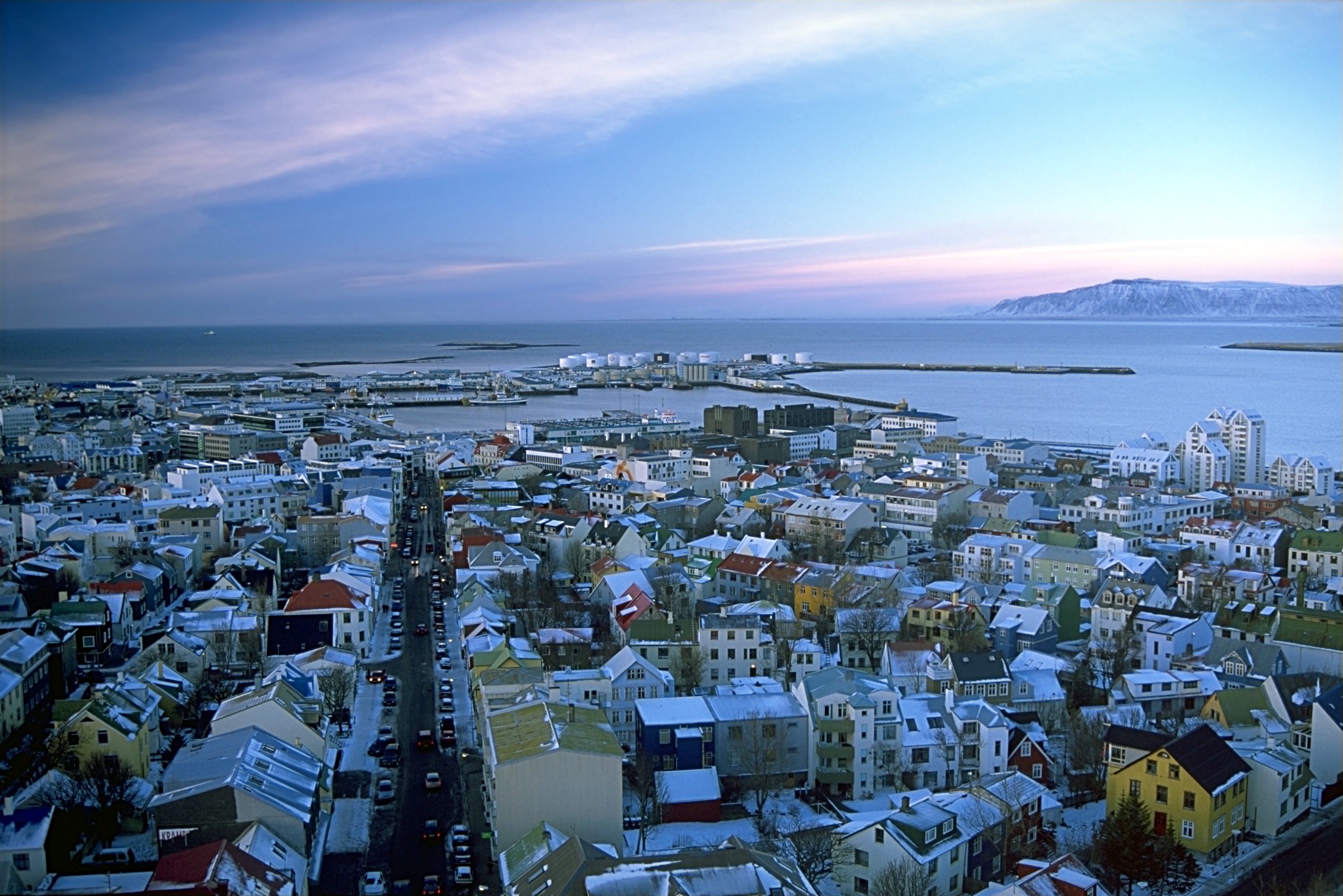
File:Reykjavík séð úr Hallgrímskirkju.jpeg
Size o this luikower: 800 × 534 pixels. Ither resolutions: 320 × 214 pixels | 640 × 427 pixels | 1,024 × 683 pixels | 1,280 × 854 pixels | 2,971 × 1,983 pixels.
Oreeginal file (2,971 × 1,983 pixels, file size: 859 KB, MIME type: image/jpeg)
| Descreeption | |||
| Date | |||
| Soorce |
Ain wirk - see http://fam-tille.de/sparetime.html |
||
| Author | Andreas Tille | ||
| Permission (Reuisin this file) |
Quote of http://fam-tille.de/island/winter/0204/2003_100.html - Permission is granted to copy, distribute and/or modify this images under the terms of the GNU Free Documentation License, Version 1.1 or any later version published by the Free Software Foundation. I, the copyright holder of this work, hereby publish it under the following licenses:
This file is licensed under the Creative Commons Attribution-Share Alike 3.0 Unported, 2.5 Generic, 2.0 Generic and 1.0 Generic license.
Ye mey select the license o yer choice. |

| Camera location | | View this and other nearby images on: OpenStreetMap |
|---|
| Camera Model | Minolta Dynax 7 |
|---|---|
| Lens | 4/35-70 |
| Filter(s) | none |
| Support | Manfrotto 190B |
| Film | Kodak Elitechrome Extracolor |
File history
Clap oan ae date/time fer tae see the file aes it kithed at that time.
| Date/Time | Thummnail | Dimensions | Uiser | Comment | |
|---|---|---|---|---|---|
| current | 05:49, 11 August 2005 | | 2,971 × 1,983 (859 KB) | Tillea | |
| 13:38, 2 December 2004 |  | 2,963 × 1,978 (2.9 MB) | Ævar Arnfjörð Bjarmason |
Eimage airtins
The follaein pages airts tae this image:
Global file uisage
The follaein ither wikis uise this file:
- Uisage on af.wikipedia.org
- Uisage on an.wikipedia.org
- Uisage on ar.wikipedia.org
- Uisage on avk.wikipedia.org
- Uisage on be-tarask.wikipedia.org
- Uisage on be.wikipedia.org
- Uisage on bn.wikipedia.org
- Uisage on br.wikipedia.org
- Uisage on ca.wikipedia.org
- Uisage on csb.wikipedia.org
- Uisage on cv.wikipedia.org
- Uisage on cy.wikipedia.org
- Uisage on da.wikipedia.org
- Uisage on de.wikipedia.org
- Uisage on de.wikibooks.org
- Uisage on dsb.wikipedia.org
- Uisage on en.wikipedia.org
- Uisage on en.wikibooks.org
- Uisage on es.wikipedia.org
- Uisage on eu.wikipedia.org
- Uisage on ext.wikipedia.org
- Uisage on fa.wikipedia.org
- Uisage on frr.wikipedia.org
- Uisage on fr.wikipedia.org
View mair global usage o this file.