File:Relief Map of Lithuania.jpg

Size o this luikower: 800 × 600 pixels. Ither resolutions: 320 × 240 pixels | 640 × 480 pixels | 1,024 × 768 pixels | 1,200 × 900 pixels.
Oreeginal file (1,200 × 900 pixels, file size: 387 KB, MIME type: image/jpeg)
Ootline
| Descreeption |
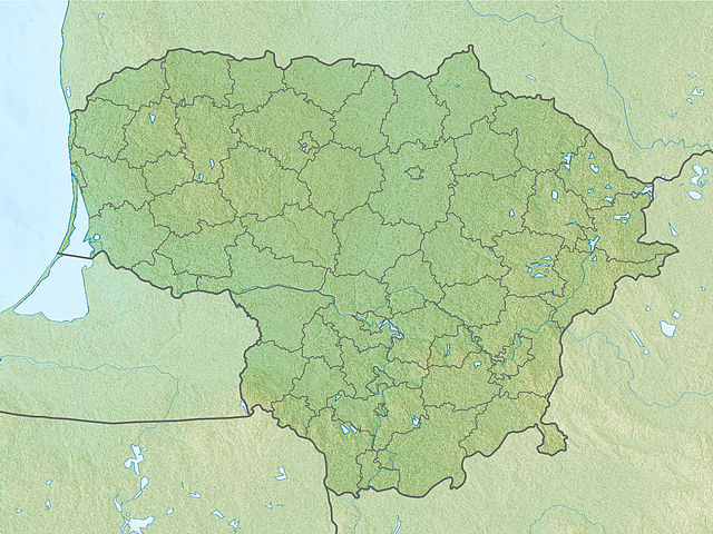
English: Location map of Lithuania Equirectangular projection, N/S stretching 170 %. Geographic limits of the map:
|
| Date | (UTC) |
| Soorce | |
| Author |
|
| This is a retouched picture, which means that it has been digitally altered from its original version. The original can be viewed here: Lithuania location map.svg:
|
Licensin
I, the copyright holder of this work, hereby publish it under the following licenses:
This file is licensed unner the Creative Commons Attribution-Share Alike 3.0 Unported license.
- Ye are free:
- tae share – tae copy, distribute an transmit the wirk
- tae remix – tae adapt the wirk
- Unner the follaein condeetions:
- attribution – Ye must attribute the wirk in the manner specified bi the author or licensor (but nae in ony way that suggests that thay endorse ye or yer uise o the wirk).
- share alik – If ye alter, transform, or big upon this wirk, ye mey distribute the resultin wirk anly unner the same or seemilar license tae this ane.

|
Permission is grantit tae copy, distribute an/or modify this document unner the terms o the GNU Free Documentation License, Version 1.2 or ony later version published bi the Free Software Foundation; wi no Invariant Sections, no Front-Cover Texts, an no Back-Cover Texts. A copy o the license is includit in the section enteetled GNU Free Documentation License. |
Ye mey select the license o yer choice.
Original upload log
This image is a derivative work of the following images:
- File:Lithuania_location_map.svg licensed with Cc-by-sa-3.0, GFDL
- 2010-03-20T22:53:54Z NordNordWest 1095x821 (111884 Bytes) update
- 2008-08-29T08:11:36Z NordNordWest 1097x822 (103917 Bytes)
- 2008-07-02T15:27:16Z NordNordWest 548x411 (126294 Bytes) {{Information |Description= {{de|Positionskarte von [[:de:Litauen|Litauen]]}} Quadratische Plattkarte, N-S-Streckung 170 %. Geographische Begrenzung der Karte: * N: 56.7° N * S: 53.7° N * W: 20.4° O * O: 27.2° O {{en|Loca
Uploaded with derivativeFX
File history
Clap oan ae date/time fer tae see the file aes it kithed at that time.
| Date/Time | Thummnail | Dimensions | Uiser | Comment | |
|---|---|---|---|---|---|
| current | 17:34, 27 November 2010 | | 1,200 × 900 (387 KB) | Виктор В | {{Information |Description={{en|Location map of Lithuania}} Equirectangular projection, N/S stretching 170 %. Geographic limits of the map: * N: 56.7° N * S: 53.7° N * W: 20.4° E * E: 27.2° E |Source=*[[:File:Lithuania_location_m |
Eimage airtins
The follaein pages airts tae this image:
Global file uisage
The follaein ither wikis uise this file:
- Uisage on als.wikipedia.org
- Uisage on an.wikipedia.org
- Uisage on ar.wikipedia.org
- Uisage on ast.wikipedia.org
- Uisage on azb.wikipedia.org
- Uisage on az.wikipedia.org
- Şablon:Yer xəritəsi Litva
- Aukştaytiya Milli Parkı
- Drukşyay gölü
- Platelyay gölü
- Klaypeda Dəmiryol Stansiyası
- Rusne adası
- İqnalina AES
- Kurş dili
- Vyante burnu
- Asveya gölü
- Çepkelyay
- Vilnüs Dəmiryolu Stansiyası
- Rambinas
- Labanoras Regional Parkı
- Tituvenay regional parkı
- Tauraqnas gölü
- Trakay Tarixi Milli Parkı
- Elektrenay su anbarı
- Uisage on ba.wikipedia.org
- Uisage on be.wikipedia.org
View mair global usage o this file.