File:Relief Map of Krasnoyarsk Krai.jpg
Size o this luikower: 350 × 600 pixels. Ither resolutions: 140 × 240 pixels | 280 × 480 pixels | 448 × 768 pixels | 597 × 1,024 pixels | 2,000 × 3,427 pixels.
Oreeginal file (2,000 × 3,427 pixels, file size: 603 KB, MIME type: image/jpeg)
Ootline
| Descreeption |
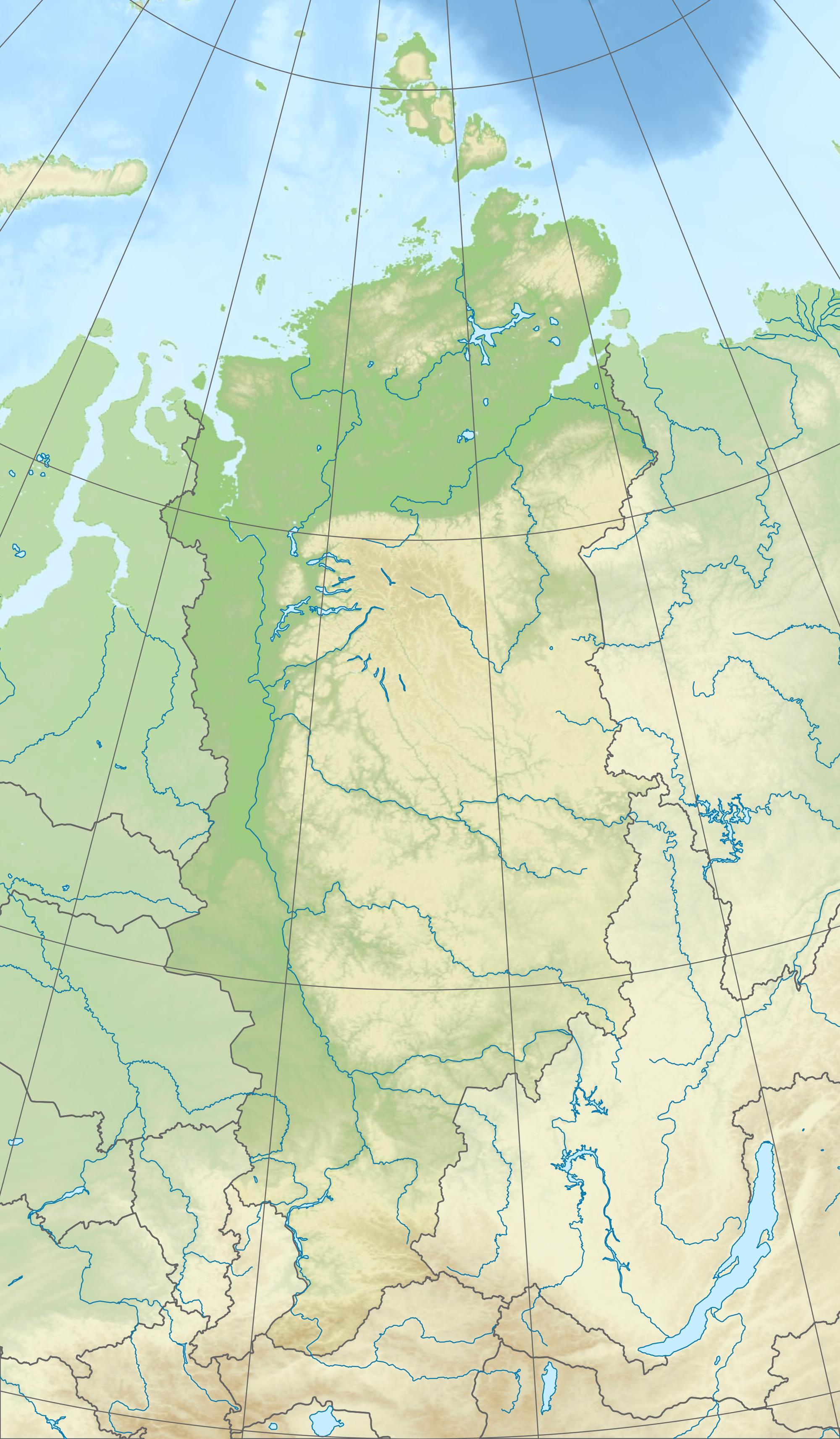
Русский: Физическая карта Красноярского края
|
| Date | |
| Soorce |
|
| Author | Виктор В |
| Other versions |
[] |


Licensin
This file is licensed under the Creative Commons Attribution-Share Alike 2.0 Generic license.
- Ye are free:
- tae share – tae copy, distribute an transmit the wirk
- tae remix – tae adapt the wirk
- Unner the follaein condeetions:
- attribution – Ye must attribute the wirk in the manner specified bi the author or licensor (but nae in ony way that suggests that thay endorse ye or yer uise o the wirk).
- share alik – If ye alter, transform, or big upon this wirk, ye mey distribute the resultin wirk anly unner the same or seemilar license tae this ane.
File history
Clap oan ae date/time fer tae see the file aes it kithed at that time.
| Date/Time | Thummnail | Dimensions | Uiser | Comment | |
|---|---|---|---|---|---|
| current | 12:48, 3 October 2010 | | 2,000 × 3,427 (603 KB) | Виктор В | + градусная сетка |
| 10:25, 3 October 2010 |  | 2,000 × 3,427 (539 KB) | Виктор В | == {{int:filedesc}} == {{Information |Description={{ru|1=Физическая карта Красноярского края *Проекция — коническая равнопромежуточная. **первая стандартная парал� |
Eimage airtins
The follaein pages airts tae this image:
Global file uisage
The follaein ither wikis uise this file:
- Uisage on ar.wikipedia.org
- Uisage on az.wikipedia.org
- Dikson adası
- Şimal Torpağı
- Şablon:Yer xəritəsi Rusiya Krasnoyarsk diyarı
- Starokadomski adası
- Pioner adası
- Trudnıy adası
- Sibiryakov adası (Krasnoyarsk diyarı)
- Morennıe
- Plavnikovye
- Arktiçeski İnstitutu adaları
- Obmannıy adası
- Zabor
- Pustoy adası
- Çyornıy adası
- Taş adası
- Zapadnıy adası
- Vostoçnıy adası
- Zabıtıy (ada)
- Sedov arxipelaqı
- İzvestiy Tsik adaları
- Krasnoflotskie adaları
- Faddey körfəzi
- Vesennıy adası
- Vollosoviç adası
- Mayski adaları
- İzvestnyakovıy adaları
- Opasnıe adaları
- Zveroboy adaları
- Kamennıe adaları
- Labirint adaları
- Plavnikovıe adaları
- Minin şxeri
- Morjov adası
- Rastorquev adası
- Vxodnıe adaları
- Şimal adası (Vxodnıe adaları)
- Oleni adaları
- Poputnıy adası
- Samoyloviç adası
- Firnley adaları
- Tillo adaları
- Kolomeysev adaları
- Myaçin adaları
- Skott-Hansen adaları
- Sverdrup adası
- Strijyov adası (Vilkiski adaları)
- Makarov buxtası
- Panfilovçular körfəzi
- Spartak buxtası
View mair global usage o this file.