File:Outline Map of Kurgan Oblast 2014.svg

Size of this PNG preview of this SVG file: 512 × 377 pixels. Ither resolutions: 320 × 236 pixels | 640 × 471 pixels | 1,024 × 754 pixels | 1,280 × 943 pixels | 2,560 × 1,885 pixels.
Oreeginal file (SVG file, nominallie 512 × 377 pixels, file size: 196 KB)
Ootline
| Descreeption |
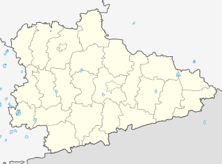
Русский: Позиционная карта Курганской области
|top    = 57.0
|bottom = 54.0
|left   = 61.7
|right  = 68.9
В этой версии файла обновлены границы городов Курган и Шадринск. |
| Date | |
| Soorce |
Ain wirk This W3C-unspecified vector image was created with Inkscape . |
| Author | Виктор В, Nzeemin, OpenStreetMap contributors |
| Other versions |
|

Licensin
This file is licensed under the Creative Commons Attribution-Share Alike 2.0 Generic license.
- Ye are free:
- tae share – tae copy, distribute an transmit the wirk
- tae remix – tae adapt the wirk
- Unner the follaein condeetions:
- attribution – Ye must attribute the wirk in the manner specified bi the author or licensor (but nae in ony way that suggests that thay endorse ye or yer uise o the wirk).
- share alik – If ye alter, transform, or big upon this wirk, ye mey distribute the resultin wirk anly unner the same or seemilar license tae this ane.
File history
Clap oan ae date/time fer tae see the file aes it kithed at that time.
| Date/Time | Thummnail | Dimensions | Uiser | Comment | |
|---|---|---|---|---|---|
| current | 18:51, 2 Mairch 2014 | | 512 × 377 (196 KB) | Nzeemin | fix for layers z-order |
| 18:44, 2 Mairch 2014 |  | 512 × 377 (195 KB) | Nzeemin | User created page with UploadWizard |
Eimage airtins
The follaein pages airts tae this image:
Global file uisage
The follaein ither wikis uise this file:
- Uisage on af.wikipedia.org
- Uisage on ba.wikipedia.org
- Тәңрекүл
- Асҡар (Ҡурған өлкәһе)
- Юламан (Ҡурған өлкәһе)
- Арыҫлан (Ҡурған өлкәһе)
- Атйетәр (Ҡурған өлкәһе)
- Абултай
- Аҙналы (Ҡурған өлкәһе)
- Кесе Солтан
- Оло Солтан
- Ҡамышлы (Сафакүл районы)
- Надеждинка (Ҡурған өлкәһе)
- Озерная (Ҡурған өлкәһе)
- Белое Озеро (Ҡурған өлкәһе)
- Субботино (Ҡурған өлкәһе)
- Бугуй
- Мырҙабай
- Бикбирҙе
- Баҡай (Ҡурған өлкәһе)
- Һарт-Әбдрәш
- Баязит (Ҡурған өлкәһе)
- Ҡалмаҡ-Әбдрәш
- Сафакүл
- Мансур (Ҡурған өлкәһе)
- Һөлөклө
- Бормат
- Максимовка (Ҡурған өлкәһе)
- Ялан (Ҡурған өлкәһе)
- Сокольники (Ҡурған өлкәһе)
- Петровка (Сафакүл районы)
- Сөләймән (Ҡурған өлкәһе)
- Шәрип (Ҡурған өлкәһе)
- Байғана
- Поляна (Ҡурған өлкәһе)
- Щучанка
- Майлыҡ
- Озерное (Әлмән районы)
- Бохара (Ҡурған өлкәһе)
- Искәндәр (Ҡурған өлкәһе)
- Ҡаҙаҡҡол (Ҡурған өлкәһе)
- Подъясово
- Киләй-Ҡаҙаҡҡол
- Зәйнәкәй
- Әлмән (Ҡурған өлкәһе)
- Ҡурған (ҡала)
- Парамоново (Ҡурған өлкәһе)
- Ҡыҙылбай
- Юлдус
- Себеркә
View mair global usage o this file.