File:Nouvelle-Aquitaine region locator map.svg

Size of this PNG preview of this SVG file: 624 × 600 pixels. Ither resolutions: 250 × 240 pixels | 499 × 480 pixels | 799 × 768 pixels | 1,066 × 1,024 pixels | 2,131 × 2,048 pixels | 2,000 × 1,922 pixels.
Oreeginal file (SVG file, nominallie 2,000 × 1,922 pixels, file size: 303 KB)
Ootline
| Descreeption |
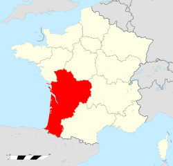
Français : Carte administrative représentant la région Nouvelle-Aquitaine sur une carte de France métropolitaine. |
| Date | |
| Soorce | Ain wirk |
| Author | Superbenjamin |
Licensin
I, the copyright holder of this work, hereby publish it under the following license:
This file is licensed under the Creative Commons Attribution-Share Alike 4.0 International license.
- Ye are free:
- tae share – tae copy, distribute an transmit the wirk
- tae remix – tae adapt the wirk
- Unner the follaein condeetions:
- attribution – Ye must attribute the wirk in the manner specified bi the author or licensor (but nae in ony way that suggests that thay endorse ye or yer uise o the wirk).
- share alik – If ye alter, transform, or big upon this wirk, ye mey distribute the resultin wirk anly unner the same or seemilar license tae this ane.
File history
Clap oan ae date/time fer tae see the file aes it kithed at that time.
| Date/Time | Thummnail | Dimensions | Uiser | Comment | |
|---|---|---|---|---|---|
| current | 11:32, 9 October 2016 | | 2,000 × 1,922 (303 KB) | Patroklis | Rétablissement des exclaves des Hautes-Pyrénées hors de la région Nouvelle-Aquitaine. |
| 17:43, 21 Februar 2016 |  | 2,000 × 1,922 (296 KB) | Superbenjamin | Rajout des iles. | |
| 17:04, 20 December 2014 |  | 2,000 × 1,922 (295 KB) | Superbenjamin | User created page with UploadWizard |
Eimage airtins
The follaein pages airts tae this image:
Global file uisage
The follaein ither wikis uise this file:
- Uisage on af.wikipedia.org
- Uisage on an.wikipedia.org
- Uisage on ar.wikipedia.org
- Uisage on arz.wikipedia.org
- Uisage on ast.wikipedia.org
- Uisage on ay.wikipedia.org
- Uisage on az.wikipedia.org
- Uisage on be-tarask.wikipedia.org
- Uisage on be.wikipedia.org
- Uisage on bg.wikipedia.org
- Uisage on br.wikipedia.org
- Uisage on ca.wikipedia.org
- Uisage on ce.wikipedia.org
- Uisage on crh.wikipedia.org
- Uisage on da.wikipedia.org
- Uisage on diq.wikipedia.org
- Uisage on el.wikipedia.org
- Uisage on eo.wikipedia.org
- Uisage on es.wikipedia.org
- Uisage on eu.wikipedia.org
- Uisage on fa.wikipedia.org
- Uisage on fr.wikipedia.org
- Région française
- Portail:Nouvelle-Aquitaine
- Catégorie:Sport en Nouvelle-Aquitaine
- Portail:Nouvelle-Aquitaine/Introduction
- Spot de kitesurf
- Élections régionales de 2010 en Poitou-Charentes
- Nouvelle-Aquitaine
- Discussion:Nouvelle-Aquitaine
- Élections régionales de 2015 en Aquitaine-Limousin-Poitou-Charentes
- Wikipédia:Statistiques des anecdotes de la page d'accueil/Visibilité des anecdotes (2016)
- Wikipédia:Statistiques des anecdotes de la page d'accueil/Visibilité des anecdotes (2016)/2016 02
- Wikipédia:Le saviez-vous ?/Archives/2016
- Utilisateur:B Chloé5/Brouillon
- Uisage on fr.wikinews.org
- Uisage on fr.wiktionary.org
- Uisage on ga.wikipedia.org
- Uisage on gl.wikipedia.org
- Uisage on he.wikipedia.org
- Uisage on hr.wikipedia.org
- Uisage on hy.wikipedia.org
- Uisage on incubator.wikimedia.org
- Uisage on io.wikipedia.org
View mair global usage o this file.