File:Netherlands location map 1944.svg

Size of this PNG preview of this SVG file: 532 × 600 pixels. Ither resolutions: 213 × 240 pixels | 426 × 480 pixels | 681 × 768 pixels | 908 × 1,024 pixels | 1,817 × 2,048 pixels | 888 × 1,001 pixels.
Oreeginal file (SVG file, nominallie 888 × 1,001 pixels, file size: 1.32 MB)
Ootline
| Descreeption |
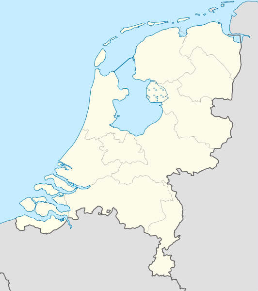
Deutsch: Positionskarte der Niederlande für das Jahr 1944
Quadratische Plattkarte, N-S-Streckung 160 %. Geographische Begrenzung der Karte:
English: Location map of the Netherlands as of 1944
Equirectangular projection, N/S stretching 160 %. Geographic limits of the map:
|
| Date | |
| Soorce |
Ain wirk This W3C-unspecified vector image was created with Adobe Illustrator. This vector image includes elements that have been taken or adapted from this file: |
| Author | Lencer |

|
This map has been made or improved in the German Kartenwerkstatt (Map Lab). You can propose maps to improve as well.
|
Licensin
I, the copyright holder of this work, hereby publish it under the following licenses:

|
Permission is grantit tae copy, distribute an/or modify this document unner the terms o the GNU Free Documentation License, Version 1.2 or ony later version published bi the Free Software Foundation; wi no Invariant Sections, no Front-Cover Texts, an no Back-Cover Texts. A copy o the license is includit in the section enteetled GNU Free Documentation License. |
This file is licensed unner the Creative Commons Attribution-Share Alike 3.0 Unported license.
- Ye are free:
- tae share – tae copy, distribute an transmit the wirk
- tae remix – tae adapt the wirk
- Unner the follaein condeetions:
- attribution – Ye must attribute the wirk in the manner specified bi the author or licensor (but nae in ony way that suggests that thay endorse ye or yer uise o the wirk).
- share alik – If ye alter, transform, or big upon this wirk, ye mey distribute the resultin wirk anly unner the same or seemilar license tae this ane.
Ye mey select the license o yer choice.
File history
Clap oan ae date/time fer tae see the file aes it kithed at that time.
| Date/Time | Thummnail | Dimensions | Uiser | Comment | |
|---|---|---|---|---|---|
| current | 09:34, 9 Julie 2011 | | 888 × 1,001 (1.32 MB) | TUBS | Lauwerszee was keeen maar, Europoort nok niet; Sloe was niet afsluiten, Neeltje Jans en de eilanden bij Goeree es Schouwen was nog niet, Sint Philipsland was en eiland |
| 17:52, 6 Julie 2011 |  | 888 × 1,001 (281 KB) | TUBS | corr | |
| 14:04, 6 Julie 2011 |  | 888 × 1,001 (281 KB) | TUBS | corr | |
| 13:59, 6 Julie 2011 |  | 888 × 1,001 (281 KB) | TUBS | == {{int:filedesc}} == {{Information |Description= {{de|Positionskarte der Niederlande für das Jahr 1944}} Quadratische Plattkarte, N-S-Streckung 160 %. Geographische Begrenzung der Karte: * N: 53.7° N * S: 50.6° N * W: 3.1° |
Eimage airtins
The follaein pages airts tae this image:
Global file uisage
The follaein ither wikis uise this file:
- Uisage on als.wikipedia.org
- Uisage on ar.wikipedia.org
- Uisage on ceb.wikipedia.org
- Uisage on ckb.wikipedia.org
- Uisage on de.wikipedia.org
- Uisage on es.wikipedia.org
- Uisage on frr.wikipedia.org
- Uisage on ka.wikipedia.org
- Uisage on mk.wikipedia.org
- Uisage on ml.wikipedia.org
- Uisage on mn.wikipedia.org
- Uisage on pl.wikipedia.org
- Uisage on pl.wikibooks.org
- Uisage on sl.wikipedia.org
- Uisage on sq.wikipedia.org
- Uisage on tg.wikipedia.org
- Uisage on war.wikipedia.org
- Uisage on xmf.wikipedia.org
- Uisage on zh.wikipedia.org