File:Netherlands location map.svg

Size of this PNG preview of this SVG file: 532 × 600 pixels. Ither resolutions: 213 × 240 pixels | 426 × 480 pixels | 681 × 768 pixels | 908 × 1,024 pixels | 1,817 × 2,048 pixels | 888 × 1,001 pixels.
Oreeginal file (SVG file, nominallie 888 × 1,001 pixels, file size: 139 KB)
Ootline
| Descreeption |
Deutsch: Positionskarte der Niederlande
Quadratische Plattkarte, N-S-Streckung 160 %. Geographische Begrenzung der Karte:
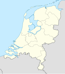
English: Location map of the Netherlands
Equirectangular projection, N/S stretching 160 %. Geographic limits of the map:
|
| Date | |
| Soorce |
own work, using
|
| Author | Lencer |
| Other versions |
|


|
This map has been made or improved in the German Kartenwerkstatt (Map Lab). You can propose maps to improve as well.
|
Licensin
I, the copyright holder of this work, hereby publish it under the following licenses:

|
Permission is grantit tae copy, distribute an/or modify this document unner the terms o the GNU Free Documentation License, Version 1.2 or ony later version published bi the Free Software Foundation; wi no Invariant Sections, no Front-Cover Texts, an no Back-Cover Texts. A copy o the license is includit in the section enteetled GNU Free Documentation License. |
This file is licensed unner the Creative Commons Attribution-Share Alike 3.0 Unported license.
- Ye are free:
- tae share – tae copy, distribute an transmit the wirk
- tae remix – tae adapt the wirk
- Unner the follaein condeetions:
- attribution – Ye must attribute the wirk in the manner specified bi the author or licensor (but nae in ony way that suggests that thay endorse ye or yer uise o the wirk).
- share alik – If ye alter, transform, or big upon this wirk, ye mey distribute the resultin wirk anly unner the same or seemilar license tae this ane.
Ye mey select the license o yer choice.
File history
Clap oan ae date/time fer tae see the file aes it kithed at that time.
| Date/Time | Thummnail | Dimensions | Uiser | Comment | |
|---|---|---|---|---|---|
| current | 11:26, 5 Januar 2019 | | 888 × 1,001 (139 KB) | Thayts | small border corrections |
| 12:26, 2 Januar 2019 |  | 888 × 1,001 (139 KB) | Thayts | fixed border segments | |
| 11:54, 30 December 2018 |  | 888 × 1,001 (145 KB) | NordNordWest | upd 2019 | |
| 22:25, 17 Februar 2013 |  | 888 × 1,001 (153 KB) | Io Herodotus | added Maasvakte2 | |
| 16:57, 31 Julie 2012 |  | 888 × 1,001 (145 KB) | NordNordWest | upd | |
| 16:56, 31 Julie 2012 |  | 888 × 1,001 (145 KB) | NordNordWest | upd | |
| 17:32, 3 Mairch 2011 |  | 888 × 1,001 (225 KB) | Lencer | fix border | |
| 16:26, 11 September 2008 |  | 888 × 1,001 (230 KB) | Lencer | {{Information |Description= |Source= |Date= |Author= |Permission= |other_versions= }} | |
| 15:15, 10 September 2008 |  | 888 × 1,001 (230 KB) | Lencer | {{Information |Description= |Source= |Date= |Author= |Permission= |other_versions= }} | |
| 18:35, 9 September 2008 |  | 888 × 1,001 (229 KB) | Lencer | {{Information |Description= |Source= |Date= |Author= |Permission= |other_versions= }} |
Eimage airtins
The follaein pages airts tae this image:
Global file uisage
The follaein ither wikis uise this file:
- Uisage on af.wikipedia.org
- Uisage on als.wikipedia.org
- Uisage on am.wikipedia.org
- Uisage on an.wikipedia.org
View mair global usage o this file.