File:Meer - Hvar 3.jpg

Oreeginal file (5,184 × 3,456 pixels, file size: 11.43 MB, MIME type: image/jpeg)
| Camera location | | View this and other nearby images on: OpenStreetMap |
|---|
| Descreeption | |||
| Date | |||
| Soorce | Ain wirk | ||
| Author | |||
| Permission (Reuisin this file) |
Deutsch: Lizenz: CC BY-SA 3.0 oder LAL.
Ich würde mich sehr über die Zusendung eines Belegexemplares bzw. der Angabe der Internetseite, wo das Foto benutzt wird, freuen. Vielen Dank! Kontakt: photos@spacebirdy.org English: Licence: CC BY-SA 3.0 or FAL.
I would be happy to receive a specimen copy or the URL of the website where the image is used, kind thanks. Contact: photos@spacebirdy.org Español: Licencia: CC BY-SA 3.0 o LAL.
Me alegraría si me mande un ejemplar de prueba o me deje saber dónde está usando la imagen, muchas gracias. Contacto: photos@spacebirdy.org Français : Licence: CC BY-SA 3.0 ou LAL.
Naturellement je serais trés heureuse de recevoir un exemplaire justificatif ou être informée d'où la photo est utilisée sur l'internet. Merci beaucoup! Contact: photos@spacebirdy.org Íslenska: Leyfi: CC BY-SA 3.0 eða FAL.
Það væri svo frábært að senda mér sýnisútgáfu eða að láta mig vita á hvaða vefsíðu þú ert að nota myndina, takk fyrir. Hafa samband: photos@spacebirdy.org I, the copyright holder of this work, hereby publish it under the following licenses: This file is licensed unner the Creative Commons Attribution-Share Alike 3.0 Unported license.
Ye mey select the license o yer choice. |
||
| Other versions | User:Spacebirdy/Myndir |
File history
Clap oan ae date/time fer tae see the file aes it kithed at that time.
| Date/Time | Thummnail | Dimensions | Uiser | Comment | |
|---|---|---|---|---|---|
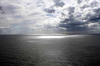
| current | 23:22, 18 October 2012 | | 5,184 × 3,456 (11.43 MB) | Spacebirdy | {{Location dec|43.140178|16.572778}} {{Information | Description = {{de|Blick aufs Meer von Hvar (Kroatien) aus.}} | Source = own | Date = 2012-10-16 | Author = {{User:Spacebirdy/geimfuglinn}} | Permission= GFDL / cc-by-sa-... |
Eimage airtins
The'r nae pages airts tae this eimage.