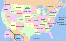
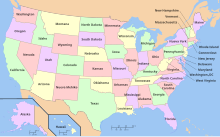
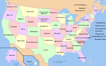
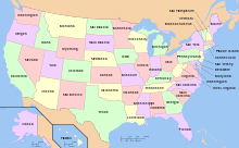
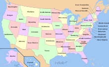
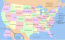
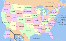
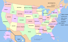
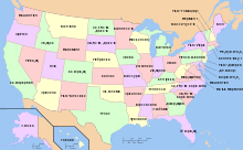
File:Map of USA with state names pt.svg

Size of this PNG preview of this SVG file: 800 × 495 pixels. Ither resolutions: 320 × 198 pixels | 640 × 396 pixels | 1,024 × 633 pixels | 1,280 × 791 pixels | 2,560 × 1,583 pixels | 959 × 593 pixels.
Oreeginal file (SVG file, nominallie 959 × 593 pixels, file size: 334 KB)
This file is fae Wikimedia Commons n micht be uised bi ither waurks. The descreeption oan its file descreeption page thaur is shawn ablo.
| This is a retouched picture, which means that it has been digitally altered from its original version. The original can be viewed here: Map of USA with state names.svg:
|
I, the copyright holder of this work, hereby publish it under the following licenses:
This file is licensed under the Creative Commons Attribution-Share Alike 3.0 Unported, 2.5 Generic, 2.0 Generic and 1.0 Generic license.
- Ye are free:
- tae share – tae copy, distribute an transmit the wirk
- tae remix – tae adapt the wirk
- Unner the follaein condeetions:
- attribution – Ye must attribute the wirk in the manner specified bi the author or licensor (but nae in ony way that suggests that thay endorse ye or yer uise o the wirk).
- share alik – If ye alter, transform, or big upon this wirk, ye mey distribute the resultin wirk anly unner the same or seemilar license tae this ane.
| This file is licensed unner the Creative Commons Attribution-Share Alike 3.0 Unported license. | ||
| ||
| This licensing tag was added to this file as part of the GFDL licensing update.http://creativecommons.org/licenses/by-sa/3.0/CC BY-SA 3.0Creative Commons Attribution-Share Alike 3.0truetrue |

|
Permission is grantit tae copy, distribute an/or modify this document unner the terms o the GNU Free Documentation License, Version 1.2 or ony later version published bi the Free Software Foundation; wi no Invariant Sections, no Front-Cover Texts, an no Back-Cover Texts. A copy o the license is includit in the section enteetled GNU Free Documentation License.http://www.gnu.org/copyleft/fdl.htmlGFDLGNU Free Documentation Licensetruetrue |
Ye mey select the license o yer choice.
Original upload log
This image is a derivative work of the following images:
- File:Map_of_USA_with_state_names.svg licensed with Cc-by-sa-3.0,2.5,2.0,1.0, Cc-by-sa-3.0-migrated, GFDL
- 2010-06-09T00:13:46Z Ras67 959x593 (342201 Bytes) frame removed
- 2007-06-11T13:23:48Z Andrew c 959x593 (339488 Bytes)
- 2007-04-17T06:15:06Z Andrew c 959x593 (336711 Bytes)
- 2005-12-28T18:36:54Z Dbenbenn 959x593 (317355 Bytes) fix error in
- 2005-10-09T22:14:30Z Dbenbenn 959x593 (339217 Bytes) fixed by [[User:Ed g2s]] (removed tag), and me (removed undisplayed shapes: rivers, lakes, capitals, highways. Cropped. Fixed typos.)
- 2005-10-09T22:12:53Z Dbenbenn 990x855 (978926 Bytes) original version from [[w:Image:Map of USA with state names.svg]] by [[w:User:Wapcaplet]], cc-by-2.0
Uploaded with derivativeFX
Captions
Add a one-line explanation of what this file represents
Items portrayed in this file
depicts
copyright status Inglis
copyrighted Inglis
31 December 2010
File history
Clap oan ae date/time fer tae see the file aes it kithed at that time.
| Date/Time | Thummnail | Dimensions | Uiser | Comment | |
|---|---|---|---|---|---|
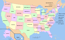
| current | 23:07, 31 December 2010 |  | 959 × 593 (334 KB) | Luan | {{Information |Description=Mapa dos estados dos Estados Unidos, com a legenda em português. |Source=*File:Map_of_USA_with_state_names.svg |Date=2010-12-31 23:03 (UTC) |Author=*File:Map_of_USA_with_state_names.svg: '''user:Dbenbenn''' *de |
Eimage airtins
The'r nae pages airts tae this eimage.
Global file uisage
The follaein ither wikis uise this file:
- Uisage on pt.wikipedia.org
- Uisage on pt.wikibooks.org


