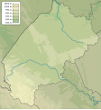
File:Lviv province physical map.svg

Size of this PNG preview of this SVG file: 533 × 571 pixels. Ither resolutions: 224 × 240 pixels | 448 × 480 pixels | 717 × 768 pixels | 956 × 1,024 pixels | 1,912 × 2,048 pixels.
Oreeginal file (SVG file, nominallie 533 × 571 pixels, file size: 632 KB)
File history
Clap oan ae date/time fer tae see the file aes it kithed at that time.
| Date/Time | Thummnail | Dimensions | Uiser | Comment | |
|---|---|---|---|---|---|
| current | 21:25, 18 December 2023 |  | 533 × 571 (632 KB) | Arvedui89 | After thirteen years I've added an ''actual'' border between Poland and Transcarpathian oblast and missing until this day border between Ivano-Frankivsk and Transcarpahian oblasts. |
| 17:34, 15 December 2010 |  | 533 × 571 (631 KB) | Urutseg | == {{int:filedesc}} == {{Information |Description={{en|1=Physical map of Lviv province, Ukraine}} {{ru|1=Физическая карта Львовской области, Украина}} |Source={{own}} |Author=Urutseg |Date=2010-12-15 |
Eimage airtins
The follaein pages airts tae this image:
Global file uisage
The follaein ither wikis uise this file:
- Uisage on ar.wikipedia.org
- Uisage on be-tarask.wikipedia.org
- Uisage on be.wikipedia.org
- Uisage on bg.wikipedia.org
- Uisage on ceb.wikipedia.org
- Uisage on ce.wikipedia.org
- Uisage on da.wikipedia.org
- Uisage on de.wikipedia.org
- Uisage on en.wikipedia.org
- Lviv
- Boryslav
- Sheptytskyi
- Horodok, Lviv Oblast
- St. George's Church, Drohobych
- Univ Lavra
- Veretskyi Pass
- Module:Location map/data/Ukraine Lviv Oblast/doc
- User:CM2G0005/sandbox
- Holy Trinity Church, Zhovkva
- Znesinnia Regional Landscape Park
- Hurkalo
- Kamianka waterfall
- Descent of the Holy Spirit Church
- Nadsianskyi Regional Landscape Park
- Module:Location map/data/Ukraine Lviv Oblast
- Stilske Horbohirya Regional Landscape Park
- Boikivshchyna National Nature Park
- Uisage on eo.wikipedia.org
View mair global usage o this file.