File:Kirovograd oblast location map.svg

Size of this PNG preview of this SVG file: 533 × 291 pixels. Ither resolutions: 320 × 175 pixels | 640 × 349 pixels | 1,024 × 559 pixels | 1,280 × 699 pixels | 2,560 × 1,398 pixels.
Oreeginal file (SVG file, nominallie 533 × 291 pixels, file size: 67 KB)
Ootline
| Descreeption |
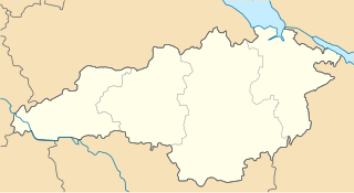
Русский: Районы Кировоградской области с 17 июля 2020 года |
| Date | |
| Soorce | Ain wirk |
| Author | RosssW |
Licensin
I, the copyright holder of this work, hereby publish it under the following license:
This file is licensed under the Creative Commons Attribution-Share Alike 4.0 International license.
- Ye are free:
- tae share – tae copy, distribute an transmit the wirk
- tae remix – tae adapt the wirk
- Unner the follaein condeetions:
- attribution – Ye must attribute the wirk in the manner specified bi the author or licensor (but nae in ony way that suggests that thay endorse ye or yer uise o the wirk).
- share alik – If ye alter, transform, or big upon this wirk, ye mey distribute the resultin wirk anly unner the same or seemilar license tae this ane.
File history
Clap oan ae date/time fer tae see the file aes it kithed at that time.
| Date/Time | Thummnail | Dimensions | Uiser | Comment | |
|---|---|---|---|---|---|
| current | 13:06, 7 August 2020 | | 533 × 291 (67 KB) | RosssW | Uploaded own work with UploadWizard |
Eimage airtins
The follaein pages airts tae this image:
Global file uisage
The follaein ither wikis uise this file:
- Uisage on be.wikipedia.org
- Крапыўныцкы
- Шаблон:На карце/Украіна Кіраваградская вобласць
- Смолінэ
- Памічна
- Далынска
- Пэтровэ (Алэксандрыйскі раён)
- Навамыргарад
- Нава Прага
- Мала Выска
- Новаўкраінка
- Знам’янка
- Галубіевычы (Народыцкі раён)
- Елызавэтградка
- Устыніўка
- Салькавэ
- Алэксандрыўка (Кіраваградская вобласць)
- Алэксандрыйскэ
- Галаваніўск
- Добравэлычкіўка
- Власіўка
- Балахіўка
- Ануфрыіўка
- Паўлыш
- Прыюціўка
- Новаархангельск
- Навэ (Кіраваградская вобласць)
- Пантаіўка
- Пабузкэ
- Наўгародка
- Маладзіжнэ (Кіраваградская вобласць)
- Лісавэ
- Капітаніўка
- Кампанііўка
- Завалля
- Знам’янка Друга
- Грамадскэ (Кіраваградская вобласць)
- Підвысокэ (Новаархангельскі раён)
- Малыніўка (Пэтрыўскі раён)
- Навасілка (Галаваніўскі раён)
- Підгайці (Крапыўныцкі раён)
- Сэмэніўка (Кампанііўскі раён)
- Сакільныкы (Знам’янскі раён)
- Вэрбіўка (Новаархангельскі раён)
- Вэрбіўка (Новаўкраінскі раён)
- Вэрхіўці (Крапыўныцкі раён)
- Вэрбовэ (Галаваніўскі раён)
- Вэрбовэ (Кампанііўскі раён)
- Бэрэслаўка
- Uisage on ce.wikipedia.org
View mair global usage o this file.