File:KhitanAD1000.png
Size o this luikower: 800 × 467 pixels. Ither resolutions: 320 × 187 pixels | 640 × 373 pixels | 1,024 × 597 pixels | 1,644 × 959 pixels.
Oreeginal file (1,644 × 959 pixels, file size: 52 KB, MIME type: image/png)
Ootline
| Descreeption |
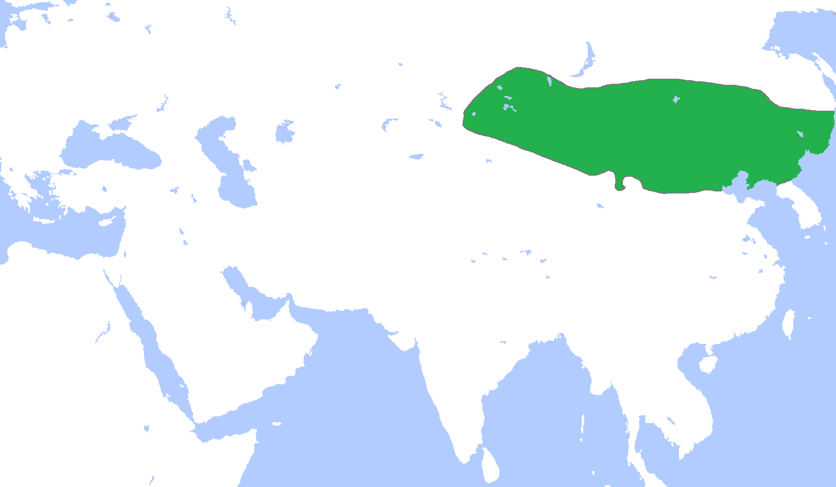
English: Locator map of the Khitan Empire, c. 1000.
(Partially based on Atlas of World History (2007) - The World 750-1000, map) |
| Date | |
| Soorce | Ain wirk |
| Author | Gabagool |
Licensin
I, the copyright holder of this work, hereby publish it under the following license:
This file is licensed under the Creative Commons Attribution 3.0 Unported license.
- Ye are free:
- tae share – tae copy, distribute an transmit the wirk
- tae remix – tae adapt the wirk
- Unner the follaein condeetions:
- attribution – Ye must attribute the wirk in the manner specified bi the author or licensor (but nae in ony way that suggests that thay endorse ye or yer uise o the wirk).
File history
Clap oan ae date/time fer tae see the file aes it kithed at that time.
| Date/Time | Thummnail | Dimensions | Uiser | Comment | |
|---|---|---|---|---|---|
| current | 02:28, 19 December 2010 | | 1,644 × 959 (52 KB) | Tm | Reverted to version as of 16:02, 18 December 2010 |
| 00:12, 19 December 2010 |  | 1,644 × 959 (52 KB) | Historiographer~commonswiki | See en:Goryeo–Khitan Wars. | |
| 16:02, 18 December 2010 |  | 1,644 × 959 (52 KB) | Tm | Reverted to version as of 01:59, 18 December 2010 (please see the warning in Category:Maps_of_Korea) | |
| 09:09, 18 December 2010 |  | 1,644 × 959 (52 KB) | Garam | Stop it. Goryeo of territory is Aprok river. Please, you can ref to wikipedia. | |
| 01:59, 18 December 2010 |  | 1,644 × 959 (52 KB) | Tm | Reverted to version as of 00:35, 18 December 2010 | |
| 00:36, 18 December 2010 |  | 1,644 × 959 (52 KB) | Historiographer~commonswiki | Reverted to version as of 00:34, 18 December 2010 | |
| 00:35, 18 December 2010 |  | 1,644 × 959 (52 KB) | Evawen | Reverted to version as of 18:29, 17 December 2010 | |
| 00:34, 18 December 2010 |  | 1,644 × 959 (52 KB) | Historiographer~commonswiki | These territory was called as a Six garrison (강동6주). You really think I'm that nationalistic? It is fact. | |
| 18:29, 17 December 2010 |  | 1,644 × 959 (52 KB) | Tm | Reverted to version as of 19:25, 16 December 2010 (please stop this nationalistic POV pushing) | |
| 02:11, 17 December 2010 |  | 1,644 × 959 (52 KB) | Historiographer~commonswiki | Reverted to version as of 06:10, 16 December 2010 |
Eimage airtins
The'r nae pages airts tae this eimage.
Global file uisage
The follaein ither wikis uise this file:
- Uisage on af.wikipedia.org
- Uisage on an.wikipedia.org
- Uisage on ar.wikipedia.org
- Uisage on ast.wikipedia.org
- Uisage on be.wikipedia.org
- Uisage on bg.wikipedia.org
- Uisage on cdo.wikipedia.org
- Uisage on ce.wikipedia.org
- Uisage on ckb.wikipedia.org
- Uisage on cs.wikipedia.org
- Uisage on en.wikipedia.org
- Uisage on es.wikipedia.org
- Uisage on eu.wikipedia.org
- Uisage on fa.wikipedia.org
- Uisage on fr.wikipedia.org
- Uisage on fr.wiktionary.org
- Uisage on id.wikipedia.org
- Uisage on ja.wikipedia.org
- Uisage on ka.wikipedia.org
- Uisage on kk.wikipedia.org
- Uisage on km.wikipedia.org
- Uisage on min.wikipedia.org
- Uisage on mk.wikipedia.org
- Uisage on mn.wikipedia.org
- Uisage on ms.wikipedia.org
- Uisage on mt.wikipedia.org
- Uisage on nl.wikipedia.org
- Uisage on no.wikipedia.org
View mair global usage o this file.