File:Italy Sardinia relief location map.svg

Size of this PNG preview of this SVG file: 334 × 599 pixels. Ither resolutions: 134 × 240 pixels | 267 × 480 pixels | 428 × 768 pixels | 571 × 1,024 pixels | 1,142 × 2,048 pixels | 601 × 1,078 pixels.
Oreeginal file (SVG file, nominallie 601 × 1,078 pixels, file size: 1.62 MB)
Ootline
| Descreeption |
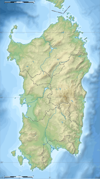
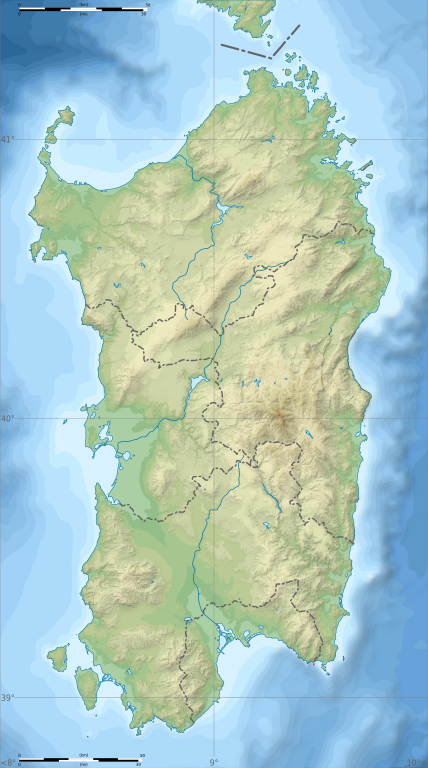
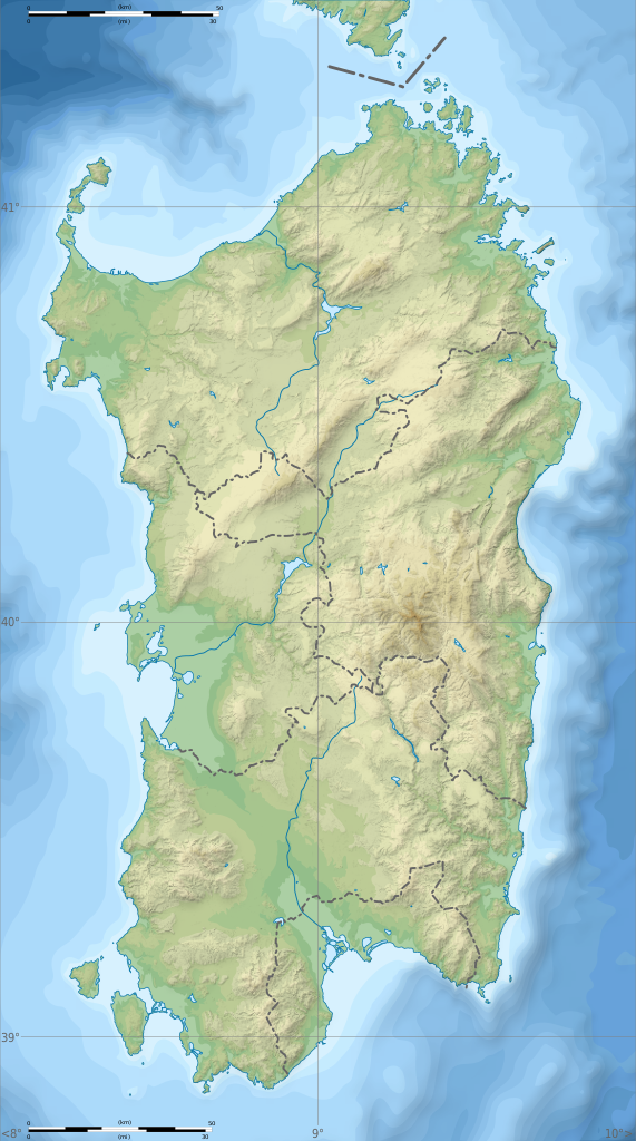
English: Blank physical map of Sardinia, Italy, for geo-location purpose, with province boundaries. Altitude levels : 25m, 50, 100, 200, 400, 600, etc. (same for bathymetry). Français : Carte topographique vierge de la Sardaigne, Italie, destinée à la géolocalisation, avec les limites des provinces. Niveaux d'altitudes : 25 m, 50, 100, 200, 400, 600, etc. Idem pour la bathymétrie.
Geographic limits of the map:
|
| Date | (UTC) |
| Soorce |
Ain wirk
|
| Author | Sémhur |
| Other versions |
Derivative works of this file: Aree protette della Sardegna.svg
|
| Attribution (required by the license) | © Sémhur / Wikimedia Commons / |
| SVG | W3C-validity not checked. |
| Atelier graphique |

| Camera location | | View this and other nearby images on: OpenStreetMap |
|---|
Licensin
I, the copyright holder of this work, hereby publish it under the following licenses:
| Copyleft: This wairk o airt is free; ye can redistreebute it n/or modifie it accordin til the terms o the Free Art License. Ye'll fynd ae specimen o this license oan the Copyleft Attitude steid aes weel aes oan ither steids. |
This file is licensed under the Creative Commons Attribution-Share Alike 4.0 International, 3.0 Unported, 2.5 Generic, 2.0 Generic and 1.0 Generic license.
- Ye are free:
- tae share – tae copy, distribute an transmit the wirk
- tae remix – tae adapt the wirk
- Unner the follaein condeetions:
- attribution – Ye must attribute the wirk in the manner specified bi the author or licensor (but nae in ony way that suggests that thay endorse ye or yer uise o the wirk).
- share alik – If ye alter, transform, or big upon this wirk, ye mey distribute the resultin wirk anly unner the same or seemilar license tae this ane.
Ye mey select the license o yer choice.
File history
Clap oan ae date/time fer tae see the file aes it kithed at that time.
| Date/Time | Thummnail | Dimensions | Uiser | Comment | |
|---|---|---|---|---|---|
| current | 15:26, 4 Mairch 2018 | | 601 × 1,078 (1.62 MB) | Ruthven | c:User:Rillke/bigChunkedUpload.js: |
| 09:29, 25 Februar 2018 |  | 601 × 1,078 (1.62 MB) | Ruthven | New province boundaries (2016) | |
| 15:29, 24 Januar 2010 |  | 601 × 1,078 (1.63 MB) | Sémhur | == {{int:filedesc}} == {{Information |Description= {{en|Blank physical map of Sardinia, Italy, for geo-location purpose, with province boundaries. Altitude levels : 25m, 50, 100, 200, 400, 600, etc. (same for bathymetry)}} {{fr|Carte topo |
Eimage airtins
The follaein pages airts tae this image:
Global file uisage
The follaein ither wikis uise this file:
- Uisage on ar.wikipedia.org
- Uisage on az.wikipedia.org
- Uisage on ba.wikipedia.org
- Uisage on be.wikipedia.org
- Uisage on bn.wikipedia.org
- Uisage on bs.wikipedia.org
- Uisage on ca.wikipedia.org
- Uisage on ceb.wikipedia.org
- Uisage on ce.wikipedia.org
- Uisage on cs.wikipedia.org
- Uisage on de.wikipedia.org
- Uisage on de.wikivoyage.org
- Uisage on dsb.wikipedia.org
- Uisage on en.wikipedia.org
- Gusana
- Punta Sardegna
- Languages of Italy
- Santo Stefano (island)
- San Pietro Island
- Punta La Marmora
- Budelli
- Mechanized Brigade "Sassari"
- Lake Baratz
- 184th Paratroopers Division "Nembo"
- 203rd Coastal Division (Italy)
- 204th Coastal Division (Italy)
- 205th Coastal Division (Italy)
- Lake Coghinas
- Lake Omodeo
- Lake Liscia
- Template:Sardinia regional languages labelled map
- Module:Location map/data/Italy Sardinia/doc
- Gulf of Oristano
- User:Michael!/Project:Location map templates/Italy
- Lake Temo
- Is Molas Challenge
- Is Molas Senior Open
- Module:Location map/data/Italy Sardinia
View mair global usage o this file.