File:Indien 1955.svg

Size of this PNG preview of this SVG file: 496 × 599 pixels. Ither resolutions: 199 × 240 pixels | 397 × 480 pixels | 636 × 768 pixels | 848 × 1,024 pixels | 1,696 × 2,048 pixels | 979 × 1,182 pixels.
Oreeginal file (SVG file, nominallie 979 × 1,182 pixels, file size: 189 KB)
Ootline
| Descreeption |
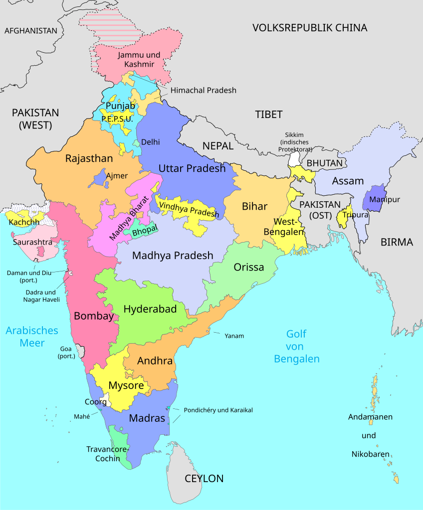
Deutsch: Politische Karte von Indien 1955. English: Political map of India, 1955. |
||
| Date | |||
| Soorce |
This file was derived from: Bilaspur-India 1951.svg |
||
| Author | Furfur | ||
| Permission (Reuisin this file) |
I, the copyright holder of this work, hereby publish it under the following licenses:
This file is licensed under the Creative Commons Attribution-Share Alike 4.0 International license.
Ye mey select the license o yer choice. |
||
| Other versions |
|


File history
Clap oan ae date/time fer tae see the file aes it kithed at that time.
| Date/Time | Thummnail | Dimensions | Uiser | Comment | |
|---|---|---|---|---|---|
| current | 20:43, 13 October 2015 | | 979 × 1,182 (189 KB) | Furfur | ... pardon, das war Indien 1951 |
| 20:41, 13 October 2015 |  | 983 × 1,182 (187 KB) | Furfur | ein Versuch mit kräftigeren Farben | |
| 19:42, 8 October 2015 |  | 979 × 1,182 (194 KB) | Furfur | {{Information |Description={{de|1=Politische Karte von Indien 1955.}}{{en|1=Political map of India, 1955.}} |Source={{Derived from|Indien 1951.svg}} |Date=2015-10-08 |Author=Furfur |Permission={{self|GFDL|cc-by-sa-4.0}} |other_versions=... |
Eimage airtins
The follaein pages airts tae this image:
Global file uisage
The follaein ither wikis uise this file:
- Uisage on de.wikipedia.org
- Uisage on es.wikipedia.org