File:Indian Ocean laea relief location map.jpg
Size o this luikower: 638 × 599 pixels. Ither resolutions: 256 × 240 pixels | 511 × 480 pixels | 818 × 768 pixels | 1,181 × 1,109 pixels.
Oreeginal file (1,181 × 1,109 pixels, file size: 1.14 MB, MIME type: image/jpeg)
Ootline
| Descreeption |
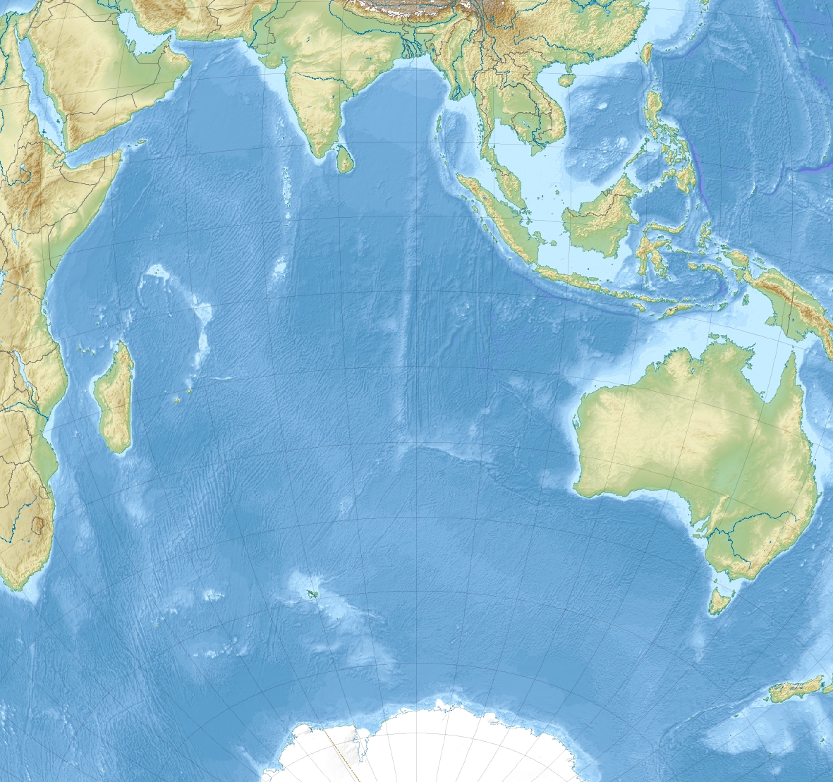
English: Relief location map of Indian Ocean.
|
| Date | |
| Soorce | Ain wirk |
| Author | Uwe Dedering |
Licensin
I, the copyright holder of this work, hereby publish it under the following licenses:
This file is licensed unner the Creative Commons Attribution-Share Alike 3.0 Unported license.
- Ye are free:
- tae share – tae copy, distribute an transmit the wirk
- tae remix – tae adapt the wirk
- Unner the follaein condeetions:
- attribution – Ye must attribute the wirk in the manner specified bi the author or licensor (but nae in ony way that suggests that thay endorse ye or yer uise o the wirk).
- share alik – If ye alter, transform, or big upon this wirk, ye mey distribute the resultin wirk anly unner the same or seemilar license tae this ane.

|
Permission is grantit tae copy, distribute an/or modify this document unner the terms o the GNU Free Documentation License, Version 1.2 or ony later version published bi the Free Software Foundation; wi no Invariant Sections, no Front-Cover Texts, an no Back-Cover Texts. A copy o the license is includit in the section enteetled GNU Free Documentation License. |
Ye mey select the license o yer choice.
File history
Clap oan ae date/time fer tae see the file aes it kithed at that time.
| Date/Time | Thummnail | Dimensions | Uiser | Comment | |
|---|---|---|---|---|---|
| current | 11:25, 4 December 2010 | | 1,181 × 1,109 (1.14 MB) | Uwe Dedering | {{Information |Description={{en|1= Relief location map of Indian_Ocean. * Projection: Lambert azimuthal equal-area projection. * Area of interest: :* N: 30.0° N :* S: -70.0° N :* W: 30.0° E :* E: 150.0° E * Projection center: :* NS: -20.0° N :* WE: 9 |
Eimage airtins
The follaein pages airts tae this image:
Global file uisage
The follaein ither wikis uise this file:
- Uisage on als.wikipedia.org
- Uisage on ar.wikipedia.org
- Uisage on ast.wikipedia.org
- Uisage on az.wikipedia.org
- Ərəbistan dənizi
- Arafur dənizi
- Timor dənizi
- Şablon:Yer xəritəsi Hind okeanı
- Lakkadiv dənizi
- Kosmonavtlar dənizi
- Ekvatorial keçidi (boğaz)
- Huvadu boğazı
- Sen-Pol adası
- Amsterdam adası
- Zond adaları
- Mouson-Pik
- Biq-Ben (Herd)
- Herd adası və Makdonald adaları
- Maskarin (vulkan)
- Bassas da İndiya adaları
- Qros Morn dağı
- Piton-de-Nej massivi
- Piton-de-Nej dağı
- Piton-de-la-Furnez
- Qloryoz adaları
- Tromelin adası
- Avropa adası
- Bank-du-Qeysir
- Eparse adaları
- Bumeranq (sualtı vulkan)
- Amsterdam vulkanı
- Uisage on ba.wikipedia.org
- Uisage on be.wikipedia.org
View mair global usage o this file.