File:Iceland relief map.jpg

Size o this luikower: 800 × 567 pixels. Ither resolutions: 320 × 227 pixels | 640 × 454 pixels | 1,024 × 726 pixels | 1,200 × 851 pixels.
Oreeginal file (1,200 × 851 pixels, file size: 161 KB, MIME type: image/jpeg)
| Descreeption |
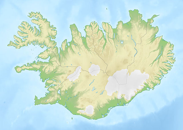
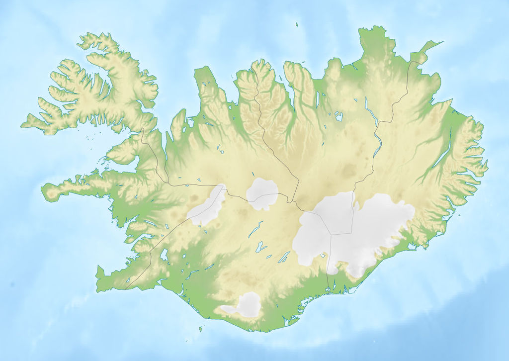
Deutsch: Positionskarte von Island
Quadratische Plattkarte, N-S-Streckung 230 %. Geographische Begrenzung der Karte: * N: 66.8° N * S: 63.1° N * W: 25° W * O: 13° W English: Location map of Iceland
Equirectangular projection, N/S stretching 230 %. Geographic limits of the map: * N: 66.8° N * S: 63.1° N * W: 25° W * E: 13° W |
| Date | (UTC) |
| Soorce |
|
| Author |
|
| This is a retouched picture, which means that it has been digitally altered from its original version. The original can be viewed here: Iceland location map.svg:
|
I, the copyright holder of this work, hereby publish it under the following licenses:
This file is licensed unner the Creative Commons Attribution-Share Alike 3.0 Unported license.
- Ye are free:
- tae share – tae copy, distribute an transmit the wirk
- tae remix – tae adapt the wirk
- Unner the follaein condeetions:
- attribution – Ye must attribute the wirk in the manner specified bi the author or licensor (but nae in ony way that suggests that thay endorse ye or yer uise o the wirk).
- share alik – If ye alter, transform, or big upon this wirk, ye mey distribute the resultin wirk anly unner the same or seemilar license tae this ane.

|
Permission is grantit tae copy, distribute an/or modify this document unner the terms o the GNU Free Documentation License, Version 1.2 or ony later version published bi the Free Software Foundation; wi no Invariant Sections, no Front-Cover Texts, an no Back-Cover Texts. A copy o the license is includit in the section enteetled GNU Free Documentation License. |
Ye mey select the license o yer choice.
Original upload log
This image is a derivative work of the following images:
- File:Iceland_location_map.svg licensed with Cc-by-sa-3.0, GFDL
- 2008-07-03T15:25:55Z NordNordWest 1186x841 (277400 Bytes) corrected
- 2008-06-30T19:38:28Z NordNordWest 1186x841 (275750 Bytes)
- 2008-06-29T17:37:15Z NordNordWest 1186x841 (279815 Bytes) {{Information |Description= {{de|Positionskarte von [[:de:Island|Island]]}} Quadratische Plattkarte, N-S-Streckung 230 %. Geographische Begrenzung der Karte: * N: 66.8° N * S: 63.1° N * W: 25° W * O: 13° W {{en|Location m
Uploaded with derivativeFX
File history
Clap oan ae date/time fer tae see the file aes it kithed at that time.
| Date/Time | Thummnail | Dimensions | Uiser | Comment | |
|---|---|---|---|---|---|
| current | 15:23, 20 October 2010 | | 1,200 × 851 (161 KB) | Виктор В | м |
| 13:39, 20 October 2010 |  | 1,000 × 709 (124 KB) | Виктор В | {{Information |Description={{de|Positionskarte von Island}} Quadratische Plattkarte, N-S-Streckung 230 %. Geographische Begrenzung der Karte: * N: 66.8° N * S: 63.1° N * W: 25° W * O: 13° W {{en|Location map of Iceland |
Eimage airtins
The follaein pages airts tae this image:
Global file uisage
The follaein ither wikis uise this file:
- Uisage on als.wikipedia.org
- Uisage on an.wikipedia.org
- Uisage on ar.wikipedia.org
- Uisage on ast.wikipedia.org
- Uisage on av.wikipedia.org
- Uisage on az.wikipedia.org
- Uisage on ban.wikipedia.org
- Uisage on ba.wikipedia.org
- Uisage on be.wikipedia.org
View mair global usage o this file.