File:DC neighborhoods map.png

Size o this luikower: 526 × 599 pixels. Ither resolutions: 211 × 240 pixels | 421 × 480 pixels | 674 × 768 pixels | 899 × 1,024 pixels | 1,493 × 1,700 pixels.
Oreeginal file (1,493 × 1,700 pixels, file size: 1.52 MB, MIME type: image/png)
Ootline
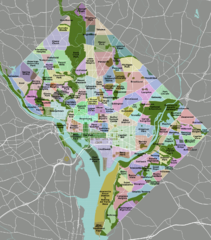
| Descreeption | DC neighborhoods map |
| Date | |
| Soorce | self-made, tracing done from PD satellite imagery |
| Author | Peter Fitzgerald |
| Permission (Reuisin this file) |
CC-by 3.0 |
| Other versions | SVG available on Wikitravel Shared, although it is not the current version, as Shared has a 8MB filesize limit... |
|
Need a higher resolution version? There's one available at File:DC neighborhoods map high res.png. (The thumbnail does not display images at such a high resolution—to access the file, click the "Full resolution" link [1] below the broken thumbnail.) |
![[1]](https://upload.wikimedia.org/wikipedia/commons/b/b8/DC_neighborhoods_map_high_res.png)
Licensin
I, the copyright holder of this work, hereby publish it under the following license:
This file is licensed under the Creative Commons Attribution 3.0 Unported license.
- Ye are free:
- tae share – tae copy, distribute an transmit the wirk
- tae remix – tae adapt the wirk
- Unner the follaein condeetions:
- attribution – Ye must attribute the wirk in the manner specified bi the author or licensor (but nae in ony way that suggests that thay endorse ye or yer uise o the wirk).

|
This locator map image could be re-created using vector graphics as an SVG file. This has several advantages; see Commons:Media for cleanup for more information. If an SVG form of this image is available, please upload it and afterwards replace this template with
{{vector version available|new image name}}.
It is recommended to name the SVG file “DC neighborhoods map.svg”—then the template Vector version available (or Vva) does not need the new image name parameter. |
File history
Clap oan ae date/time fer tae see the file aes it kithed at that time.
| Date/Time | Thummnail | Dimensions | Uiser | Comment | |
|---|---|---|---|---|---|
| current | 02:21, 2 September 2011 | | 1,493 × 1,700 (1.52 MB) | Peterfitzgerald | minor change |
| 02:15, 2 September 2011 |  | 1,493 × 1,700 (1.52 MB) | Peterfitzgerald | Lots of corrections and refinements | |
| 20:53, 4 Januar 2010 |  | 1,493 × 1,700 (1.5 MB) | Peterfitzgerald | split off Kalorama Triangle from Adams Morgan, adjusted Fairlawn & Randall Heights boundaries, & split off Spring Valley from American University Park | |
| 21:45, 30 Januar 2009 |  | 1,493 × 1,700 (1.53 MB) | Peterfitzgerald | too high res, it would seem | |
| 21:39, 30 Januar 2009 |  | 4,390 × 5,000 (5.66 MB) | Peterfitzgerald | increase resolution | |
| 14:32, 4 September 2008 |  | 1,493 × 1,700 (1.53 MB) | Peterfitzgerald | increase font size for better in-article readability | |
| 02:33, 21 Apryle 2008 |  | 1,493 × 1,700 (1.43 MB) | Peterfitzgerald | a few fixes | |
| 17:10, 14 Apryle 2008 |  | 1,493 × 1,700 (1.46 MB) | Peterfitzgerald | Separate Burleith from Georgetown | |
| 02:37, 23 Februar 2008 |  | 1,493 × 1,700 (1.41 MB) | Peterfitzgerald | {{Information |Description=DC neighborhoods map |Source=self-made, tracing done from PD satellite imagery |Date=22 February 2008 |Author= Peter Fitzgerald |Permission=CC-by-SA 3.0 |other_versions=SVG available on [http://wikitrave |
Eimage airtins
The'r nae pages airts tae this eimage.
Global file uisage
The follaein ither wikis uise this file:
- Uisage on de.wikipedia.org
- Uisage on en.wikipedia.org
- Uisage on en.wikivoyage.org
- Uisage on et.wikipedia.org
- Uisage on frr.wikipedia.org
- Uisage on ur.wikipedia.org
- Uisage on vi.wikipedia.org