File:Aberystwyth station, with a Manor 4-6-0 on train for Whitchurch, 1952 (geograph 5043029).jpg
Size o this luikower: 800 × 441 pixels. Ither resolutions: 320 × 177 pixels | 640 × 353 pixels | 1,024 × 565 pixels | 1,280 × 706 pixels | 2,346 × 1,294 pixels.
Oreeginal file (2,346 × 1,294 pixels, file size: 1.26 MB, MIME type: image/jpeg)
.jpg)
Ootline
| Descreeption |
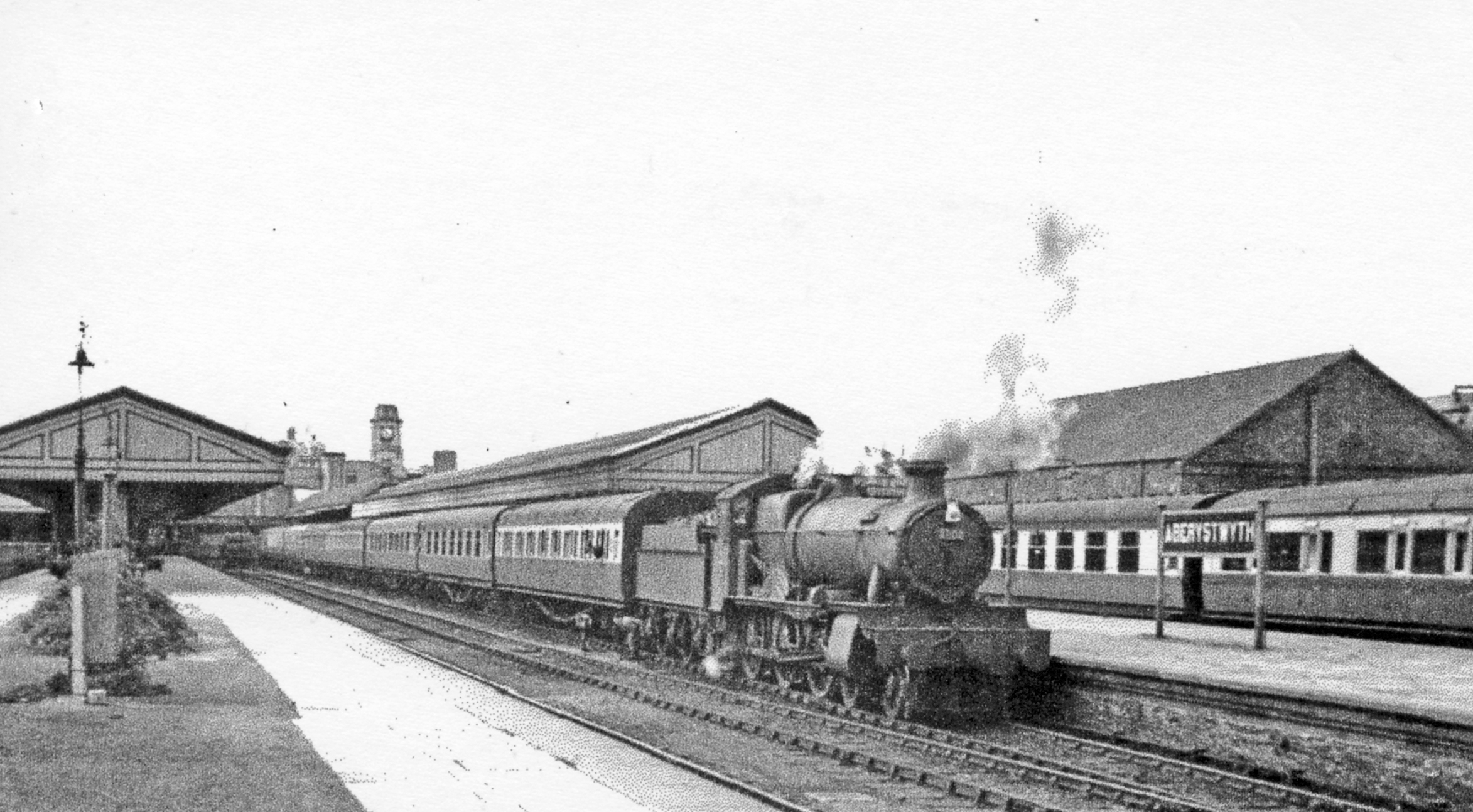
English: Aberystwyth station, with a 'Manor' 4-6-0 on train for Whitchurch, 1952 View towards the buffers of this ex-Cambrian Railway and ex-GWR terminus of lines from Whitchurch via Oswestry and Welshpool, and Pwllheli, and Machynlleth, also from Carmarthen. The 18.00 to Whitchurch is headed by Collett 'Manor' class 4-6-0 No. 7808 'Cookham Manor' (built 3/38, withdrawn 12/65 and preserved - at Didcot Railway Centre). |
| Date | |
| Soorce | From geograph.org.uk |
| Author | Walter Dendy, deceased |
| Permission (Reuisin this file) |
Creative Commons Attribution Share-alike license 2.0 |
| Attribution (required by the license) | Walter Dendy, deceased / Aberystwyth station, with a 'Manor' 4-6-0 on train for Whitchurch, 1952 / |
| Camera location | | View this and other nearby images on: OpenStreetMap |
|---|
.jpg¶ms=052.413340_N_-004.080978_E_globe:Earth_type:camera_heading:315.00_source:geograph&language=sco)
| Object location | | View this and other nearby images on: OpenStreetMap |
|---|
.jpg¶ms=052.413390_N_-004.080900_E_globe:Earth_class:object_type:object_source:geograph-osgb36(SN58568152)_region:GB-GBN_heading:315.00&language=sco)
Licensin

|
This image was taken from the Geograph project collection. See this photograph's page on the Geograph website for the photographer's contact details. The copyright on this image is owned by Walter Dendy, deceased and is licensed for reuse under the Creative Commons Attribution-ShareAlike 2.0 license.
|
This file is licensed under the Creative Commons Attribution-Share Alike 2.0 Generic license.
Attribution: Walter Dendy, deceased
- Ye are free:
- tae share – tae copy, distribute an transmit the wirk
- tae remix – tae adapt the wirk
- Unner the follaein condeetions:
- attribution – Ye must attribute the wirk in the manner specified bi the author or licensor (but nae in ony way that suggests that thay endorse ye or yer uise o the wirk).
- share alik – If ye alter, transform, or big upon this wirk, ye mey distribute the resultin wirk anly unner the same or seemilar license tae this ane.
File history
Clap oan ae date/time fer tae see the file aes it kithed at that time.
| Date/Time | Thummnail | Dimensions | Uiser | Comment | |
|---|---|---|---|---|---|
| current | 14:21, 29 Julie 2017 | | 2,346 × 1,294 (1.26 MB) | Das48 | Transferred from geograph.co.uk using [https://tools.wmflabs.org/geograph2commons/ geograph2commons] |
Eimage airtins
The follaein pages airts tae this image:
Global file uisage
The follaein ither wikis uise this file:
- Uisage on en.wikipedia.org
.jpg)