Chamartín (Madrid)
Chamartín is a admeenistrative destrict o Madrid, Spain an consists o the follaein neebourheids: El Viso, Prosperidad, Ciudad Jardín, Hispanoamérica, Nueva España, an Plaza de Castilla. It wis originally named Chamartin de la Rosa an remained a feudal estate till it wis incorporatit tae Madrid in 1948 [1]
Chamartín | |
|---|---|
 Gate o Europe touers an the Cuatro Torres Business Area unner construction | |
 | |
| Kintra | |
| Aut. commonty | |
| Municipality | |
| Madrid destrict nummer | 5 |
Owerview
eeditIt is boondit bi the Paseo de la Castellana tae the wast, the Autopista de Circunvalación M-30 tae the north an east, an the Autovía A-2 tae the sooth.
Some o the landmarks o Chamartin are the Gate o Europe, a pair o inclined office biggins; the Santiago Bernabéu Stadium, hame o the fitbaw team Real Madrid; Chamartín Station, the seicont lairgest train station in Madrid; the Cuatro Torres Business Area, a business pairk that comprises the fower tawest skyscrapers in Spain; an the Naitional Auditorium o Muisic (the main concert haw in Madrid) which hosts the Spaingie Naitional Orchestra.
Geografie
eeditSubdiveesion
eeditThe destrict is admeenistratively dividit intae 6 wairds (Barrios):
Economy
eeditThe destrict haes the heid office o Iberia an the heid office o Iberia Express.[2][3]
Photogallery
eedit-
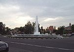 República Argentina Square
 -
 Monument tae the Spainyie Constitution
 -
 Convent o Las Madres Reparadoras
 -
 Iberia heid office
_01.jpg)
_01.jpg)
_01.jpg)
_03.jpg)
-
 Gilhou Palace
 -

-
 Edificio Bronce
 -
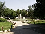 Berlín Pairk
_01.jpg)
_02.jpg)
_02.jpg)

References
eedit- ↑ Gea, Isabel. Historia de los distritos de Madrid: Chamartín. Ediciones La Libreria, 2001
- ↑ "Legal notice Archived 2011-09-29 at the Wayback Machine." Iberia. Retrieved on 25 February 2010. "IBERIA, Líneas Aéreas de España, S.A. with official address at Calle Velázquez no. 130, 28006 Madrid,"
- ↑ "Información Legal y Protección de Datos." Iberia Express. Retrieved on 15 March 2012. "Compañía Operadora de Corto y Medio Radio Iberia Express, S.A. con domicilio social en la calle Velázquez nº 130, 28006 Madrid"
Freemit airtins
eedit![]() Media relatit tae Chamartín (Madrid) at Wikimedia Commons
Media relatit tae Chamartín (Madrid) at Wikimedia Commons