File:Yeniseirivermap.png
Size o this luikower: 601 × 600 pixels. Ither resolutions: 240 × 240 pixels | 481 × 480 pixels | 988 × 986 pixels.
Oreeginal file (988 × 986 pixels, file size: 325 KB, MIME type: image/png)

|
This map image could be re-created using vector graphics as an SVG file. This has several advantages; see Commons:Media for cleanup for more information. If an SVG form of this image is available, please upload it and afterwards replace this template with
{{vector version available|new image name}}.
It is recommended to name the SVG file “Yeniseirivermap.svg”—then the template Vector version available (or Vva) does not need the new image name parameter. |
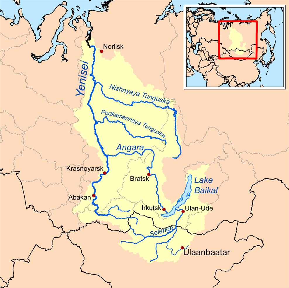
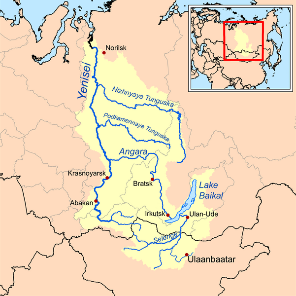
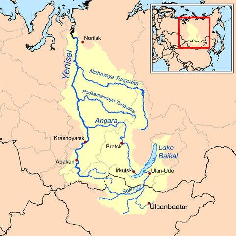
| Descreeption | This is a map of the Yenisei River drainage basin, with national borders added. |
| Date | |
| Soorce | Own work using Digital Chart of the World and GTOPO data. |
| Author | Kmusser |
|
|
This map image could be re-created using vector graphics as an SVG file. This has several advantages; see Commons:Media for cleanup for more information. If an SVG form of this image is available, please upload it and afterwards replace this template with
{{vector version available|new image name}}.
It is recommended to name the SVG file “Yeniseirivermap.svg”—then the template Vector version available (or Vva) does not need the new image name parameter. |
I, the copyright holder of this work, hereby publish it under the following license:
This file is licensed unner the Creative Commons Attribution-Share Alike 3.0 Unported license.
- Ye are free:
- tae share – tae copy, distribute an transmit the wirk
- tae remix – tae adapt the wirk
- Unner the follaein condeetions:
- attribution – Ye must attribute the wirk in the manner specified bi the author or licensor (but nae in ony way that suggests that thay endorse ye or yer uise o the wirk).
- share alik – If ye alter, transform, or big upon this wirk, ye mey distribute the resultin wirk anly unner the same or seemilar license tae this ane.
See also
File history
Clap oan ae date/time fer tae see the file aes it kithed at that time.
| Date/Time | Thummnail | Dimensions | Uiser | Comment | |
|---|---|---|---|---|---|
| current | 13:32, 26 October 2013 | | 988 × 986 (325 KB) | Ras67 | cropped, opt. |
| 18:10, 15 September 2008 |  | 1,000 × 1,000 (414 KB) | Kmusser | {{Information |Description=This is a map of the Yenisei River drainage basin. |Source=Own work using http://www.maproom.psu.edu/dcw/ Digital Chart of the World and [[http://edc.usgs.gov/products/elevation/gtopo30/gtopo30.html GTO |
Eimage airtins
The'r nae pages airts tae this eimage.
Global file uisage
The follaein ither wikis uise this file:
- Uisage on af.wikipedia.org
- Uisage on am.wikipedia.org
- Uisage on ar.wikipedia.org
- Uisage on arz.wikipedia.org
- Uisage on ast.wikipedia.org
- Uisage on azb.wikipedia.org
- Uisage on be.wikipedia.org
- Uisage on bh.wikipedia.org
- Uisage on bn.wikipedia.org
- Uisage on bs.wikipedia.org
- Uisage on ca.wikipedia.org
- Uisage on cs.wikipedia.org
- Uisage on cy.wikipedia.org
- Uisage on da.wikipedia.org
- Uisage on de.wikipedia.org
- Uisage on en.wikipedia.org
- Lake Baikal
- Angara
- Yenisey
- Nizhnyaya Tunguska
- New Order (Nazism)
- Soyot
- User:Kmusser/Images
- Tungusic peoples
- Dené–Yeniseian languages
- List of Russian explorers
- Demid Pyanda
- Wikipedia:Graphics Lab/Illustration workshop/Archive/Jan 2011
- Axis powers negotiations on the division of Asia
- Physochlaina
- Yenisei Inscriptions
- Uisage on eo.wikipedia.org
View mair global usage o this file.