File:Tokyo-to géolocalisation.svg

Size of this PNG preview of this SVG file: 800 × 488 pixels. Ither resolutions: 320 × 195 pixels | 640 × 390 pixels | 1,024 × 625 pixels | 1,280 × 781 pixels | 2,560 × 1,561 pixels | 1,720 × 1,049 pixels.
Oreeginal file (SVG file, nominallie 1,720 × 1,049 pixels, file size: 1.89 MB)
Ootline
| Camera location | | View this and other nearby images on: OpenStreetMap |
|---|
| Descreeption |
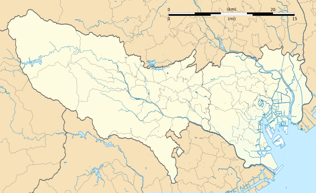
Français : Carte vierge de la préfecture métropolitaine de Tokyo (東京都, Tōkyō-to), au Japon, destinée à la géolocalisation.
Deutsch: Karte der Präfektur Tokio.
English: Blank map of the prefecture of en:Tokyo, for geolocalisation purpose.
Español: Mapa de la prefectura de Tokio.
Italiano: Mappa della metropoli di it:Tokyo.
日本語: 東京都の地図.
한국어: 도쿄도의 지도.
Português: Carta de la Metrópole de Tóquio.
|
||
| Date | (UTC) | ||
| Soorce |
Création personnelle ;
|
||
| Author | © Bourrichon (talk) - fr:Bourrichon | ||
| Permission (Reuisin this file) |
|
||
| Other versions | File:Tokyo-to géolocalisation relief.svg |

|
This SVG file contains embedded text that can be translated into your language, using any capable SVG editor, text editor or the SVG Translate tool. For more information see: About translating SVG files. |
This W3C-unspecified vector image was created with Inkscape .
Licensin
I, the copyright holder of this work, hereby publish it under the following license:
This file is licensed under the Creative Commons Attribution-Share Alike 2.0 France license.
Attribution: Bourrichon (atelier graphique)
- Ye are free:
- tae share – tae copy, distribute an transmit the wirk
- tae remix – tae adapt the wirk
- Unner the follaein condeetions:
- attribution – Ye must attribute the wirk in the manner specified bi the author or licensor (but nae in ony way that suggests that thay endorse ye or yer uise o the wirk).
- share alik – If ye alter, transform, or big upon this wirk, ye mey distribute the resultin wirk anly unner the same or seemilar license tae this ane.

File history
Clap oan ae date/time fer tae see the file aes it kithed at that time.
| Date/Time | Thummnail | Dimensions | Uiser | Comment | |
|---|---|---|---|---|---|
| current | 19:29, 2 Julie 2013 | | 1,720 × 1,049 (1.89 MB) | Bourrichon | +quelques rivières |
| 18:43, 2 Julie 2013 |  | 1,720 × 1,049 (1.06 MB) | Bourrichon | == {{int:filedesc}} == {{Location|35|70|00|N|139|00|00|E|scale:10000}} {{Information |Description= {{fr|Carte vierge de la préfecture métropolitaine de Tokyo (東京都, ''Tōkyō-to''), au Japon, destinée ... |
Eimage airtins
The follaein pages airts tae this image:
Global file uisage
The follaein ither wikis uise this file:
- Uisage on ar.wikipedia.org
- Uisage on az.wikipedia.org
- Uisage on ceb.wikipedia.org
- Uisage on de.wikipedia.org
- Uisage on en.wikipedia.org
- Akihabara
- Shibuya
- Harajuku
- Ōta, Tokyo
- Tokyo Station
- Ōsaki Station
- Shinagawa Station
- Tamachi Station (Tokyo)
- Hamamatsuchō Station
- Harajuku Station
- Shinjuku Station
- Yūrakuchō Station
- Gotanda Station
- Meguro Station
- Ebisu Station (Tokyo)
- Ueno Station
- Ikebukuro Station
- Shibuya Station
- Shimbashi Station
- Yoyogi Station
- Keiō-hachiōji Station
- Okachimachi Station
- Akihabara Station
- Kanda Station (Tokyo)
- Yokota Air Base
- Nakano Station (Tokyo)
- Ochanomizu Station
- Iidabashi Station
- Tokyo Metropolitan University
- Chōfu Airport
- Takadanobaba Station
- Kyōbashi Station (Tokyo)
- Kabukichō
- Sengaku-ji
- Mejiro Station
- Nishi-Nippori Station
- Nippori Station
- Shin-Ōkubo Station
- Ōtsuka Station
- Sugamo Station
- Komagome Station
- Tachikawa Station
- Futako-tamagawa Station
- Shimo-kitazawa Station
View mair global usage o this file.